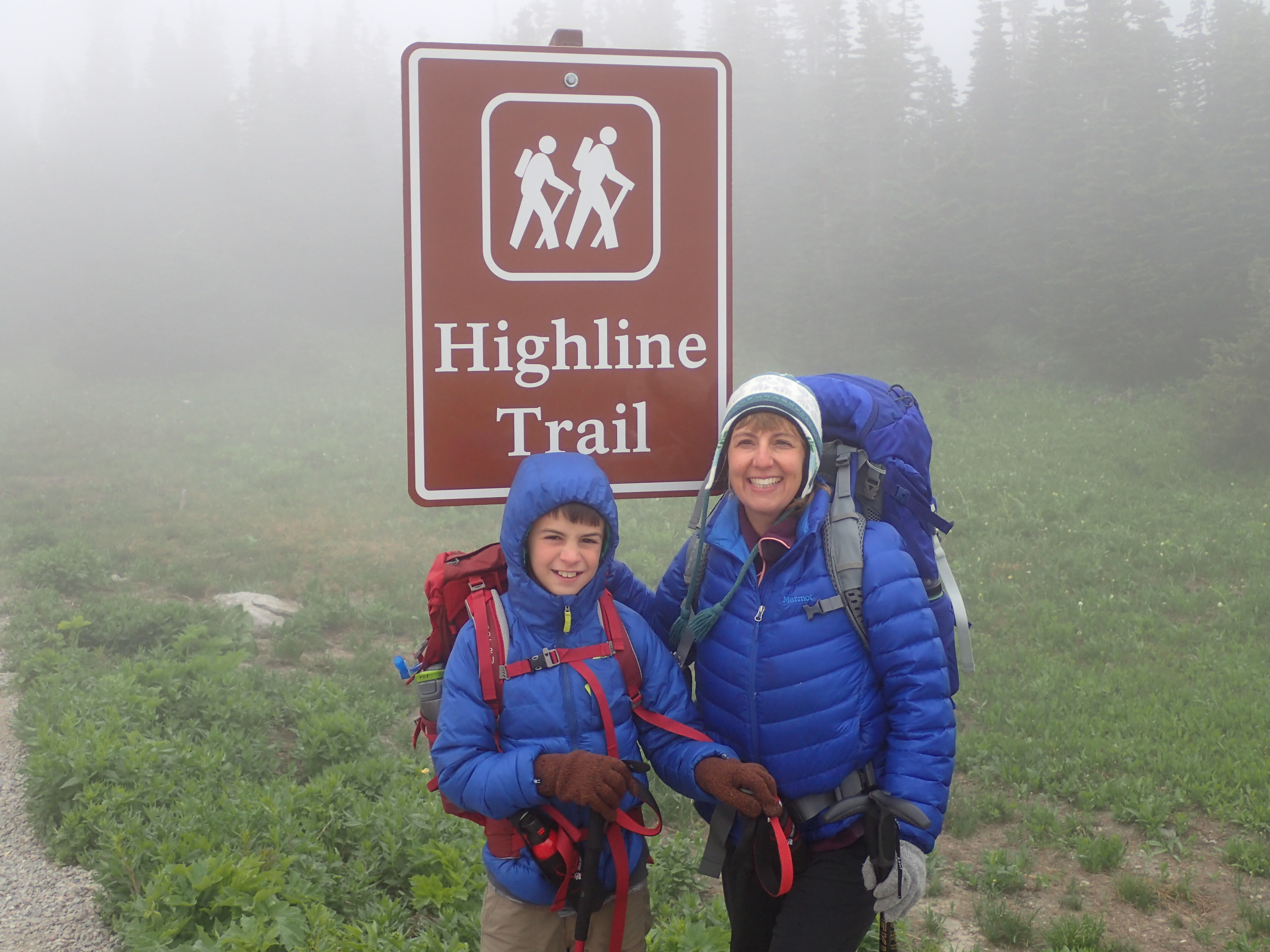
The Adventure Begins
You’ve looked over some peaks and found one that fits your physical abilities and climbing experience. Your friends are stoked and everyone’s packs are loaded with the essentials. Now it’s time to actually head out and start the adventure.
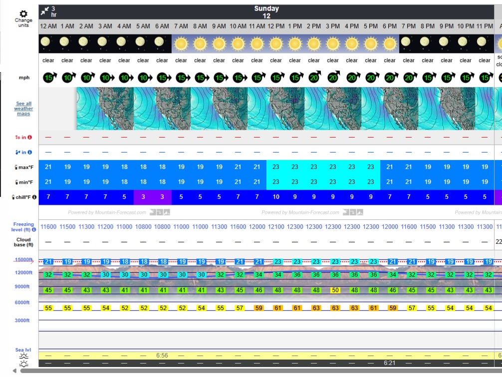
Did you check the weather forecast? I recommend looking at two weather opinions. Plan for the worst of them. NOAA.GOV is a decent site for basic forecasting. I also use MOUNTAIN-FORECAST.com This is a particularly useful site for climbers. Mountain Forecast will give you the temperature, frost line, and wind speed for three different elevations on a mountain. Recognizing a 20 degree temperature difference from the trail head with 30mph winds at your summit will help you make informed decisions on clothing choices. It can also help keep you aware of potential hazards such as verglas (a thin layer of ice on rock).
You’re almost ready to get to the trail head. Just one more very important thing left to do… write up your itinerary and leave it with a friend. In the unlikely event of a mishap (remember, always plan for the worst) a climbing plan will help bring rescue personnel to you faster and with the appropriate resources. It doesn’t have to be a novel, but the more information that is available on your itinerary, the better prepared an emergency response can be.
- Names and contact info of everyone in your party (include InReach info)
- Description of clothing and pack colors (I always recommend bright clothing)
- Trail head name and departure time
- Vehicle description(s) at trail head
- Planned route. Include any expected hazards
- Turn-around time (set one and stick to it!)
- Planned exit time and location
- List of contact names and numbers in case of emergency
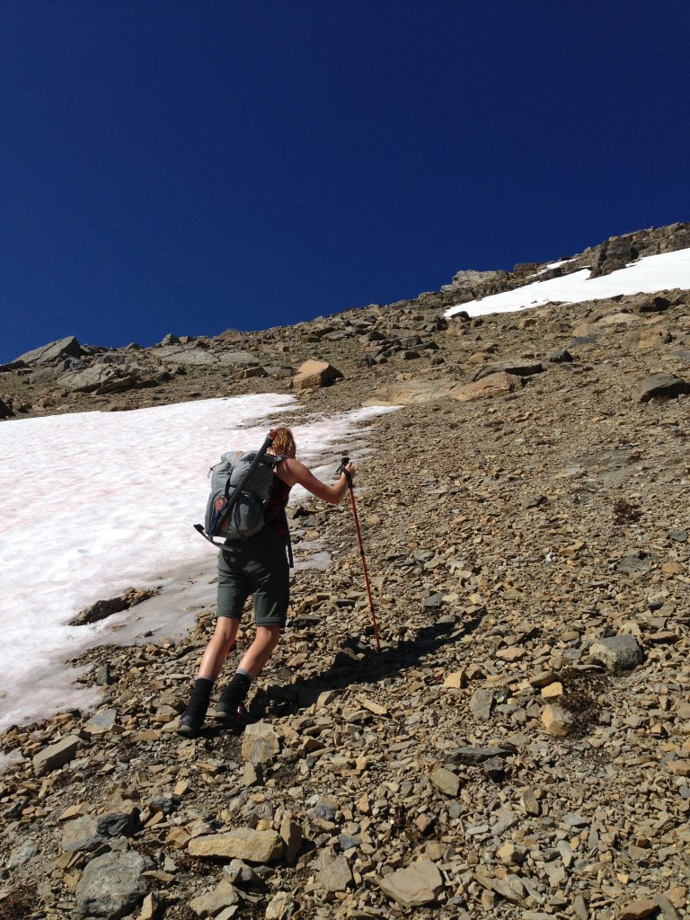
You’ve hit the trail and started your adventure for the day. At some point you will head “off-trail” and make an ascent toward the peak. You’re likely to encounter scree (a layer of small loose rocks). This is a good time to put on gaiters and bust out the trekking poles. Try to avoid scree and stick to solid rock on the way up. Scree makes for a much more enjoyable descent. You’ll soon learn to love “scree skiing.” Take this opportunity to scout the route above you.
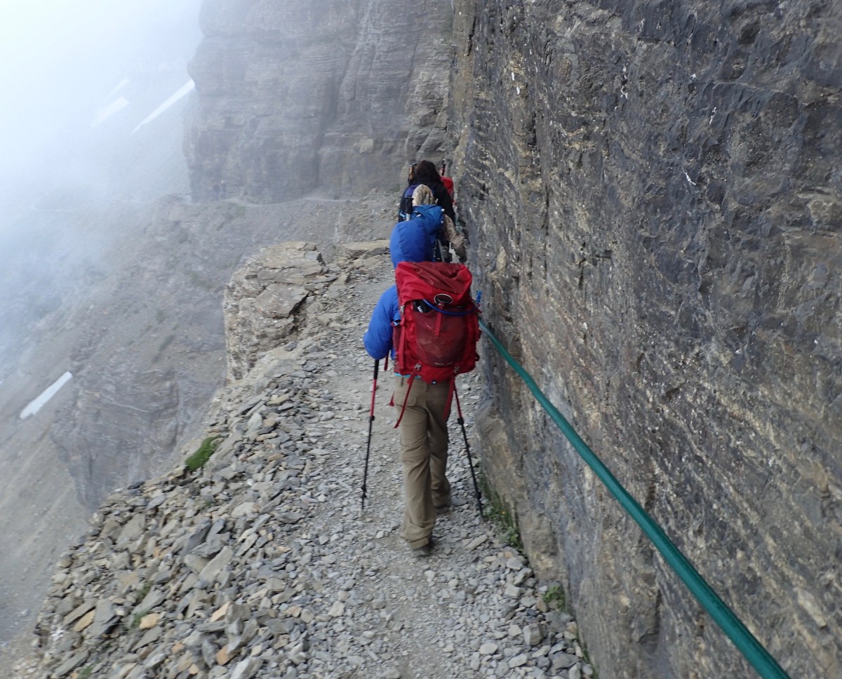
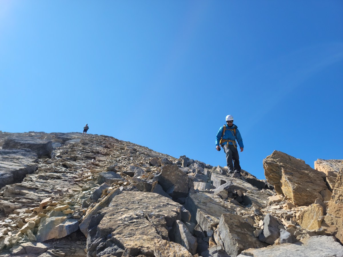
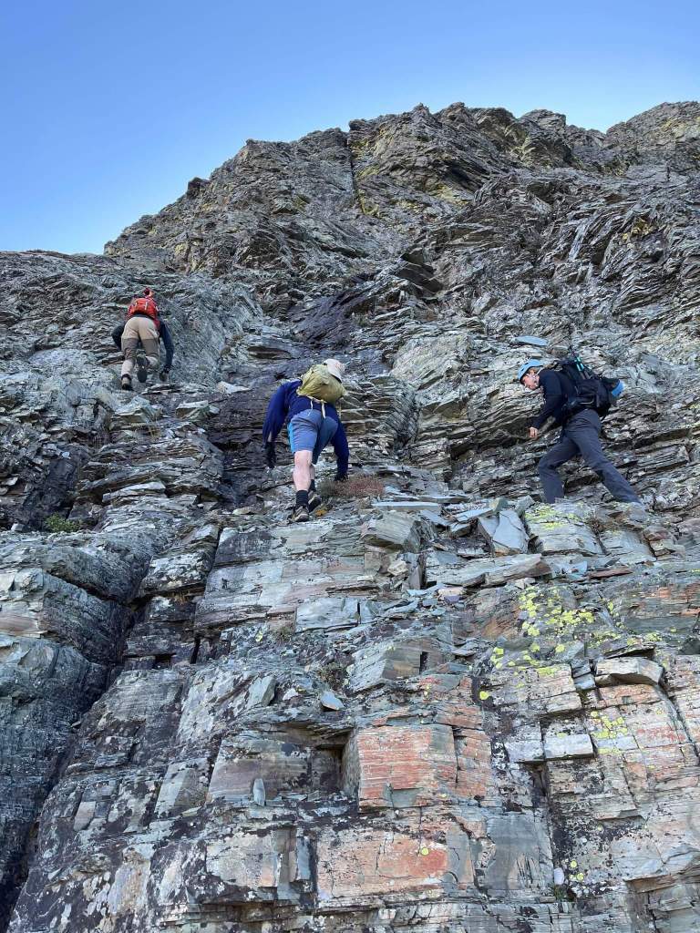
Soon enough you will be in classic GNP cliff bands and ledges. Now is a good time to put on that HELMET. This is the most enjoyable part in my humble opinion. I love getting hands on rock and scrambling through ledges and gulleys. There are a few things to keep in mind during this part: 1. Route Finding, 2. Spacing, 3. Rockfall, 4. Pace
Route finding within cliff bands can be challenging. It can be difficult to see what’s directly above you. If you choose a route up that gets you “cliffed-out” you will have to go back down a bit and find another route. Heaven forbid you get so cliffed-out you can’t even descend at all. Keep in mind that you want a route that will also be easy to descend. Ascending and down-climbing are different beasts. If you encounter an area of difficulty that is greater than the route description… you are probably off route and should be heading in a different direction.
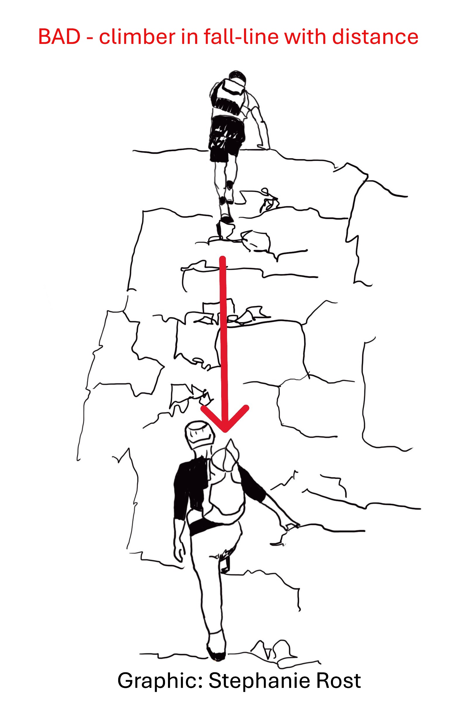
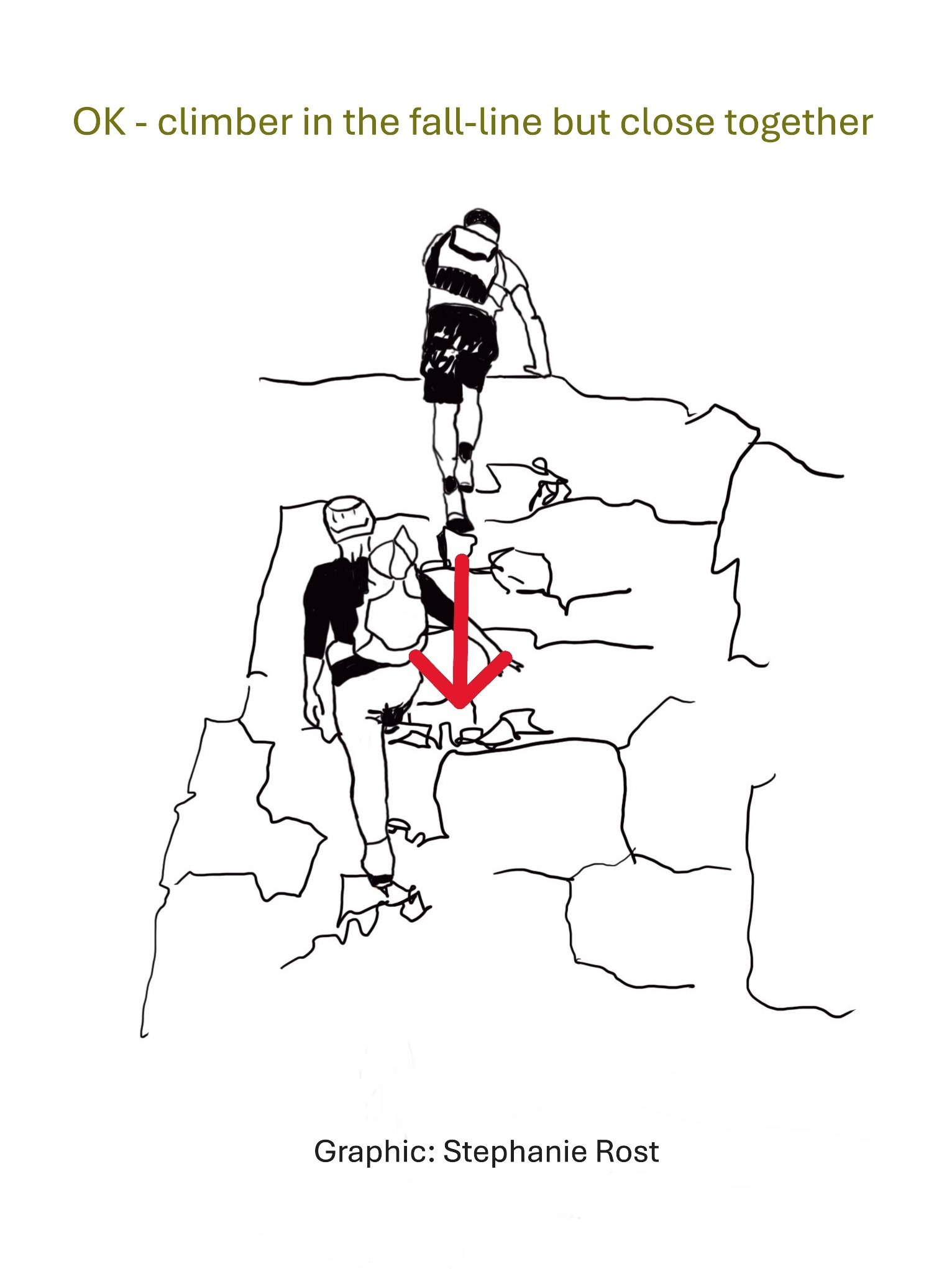
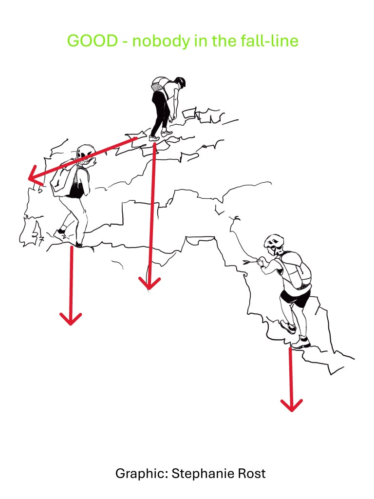
Spacing of climbers on steep or vertical terrain is a critical component of safe climbing. This is where every member of the team needs to be paying attention. The rock quality in Glacier Park is horrible and you WILL knock rocks down. Understanding gravity and the “fall-line” will help keep your team safe. The goal with spacing is to either keep all climbers out of the fall-line or stay so close together that a tumbling rock would not have any consequential speed.
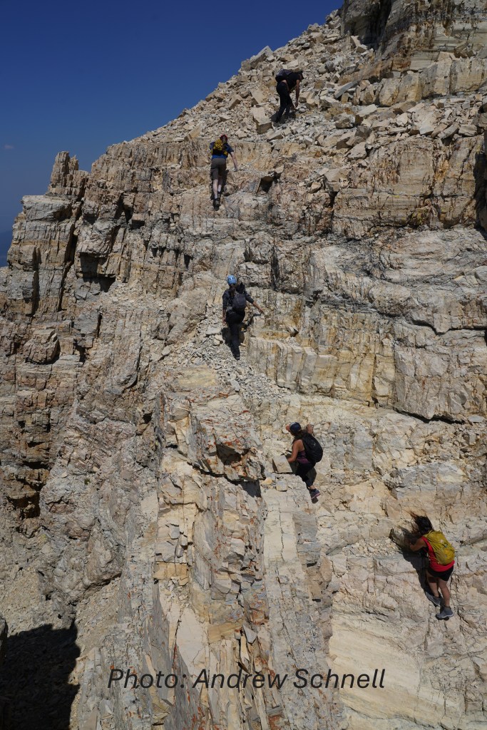
Keep an eye on your team. Are they lagging behind? Do you notice apprehension about exposure? Are they taking undue risks? Are they staying hydrated? These are things to consider when assessing whether or not to continue with a climb. Never be afraid to speak up and voice a concern. Some times the best decision is to simply call it a day and turn around.
When it comes to the pace of the climbing team I like to use a benchmark of 1,000′ per hour. If your team is slower than that it’s time to do some math and figure out if you will make it to the top before your turnaround time. Along these lines I also have some recommendations for team endurance:
Every hour of heavy exertion or 1,000′ elevation gain (click arrow):
Take a quick break…
Eat something, drink something
I suggest ~200 calories. Include some carbs so you don’t BONK
Reassess team fitness and dynamics
Reassess weather
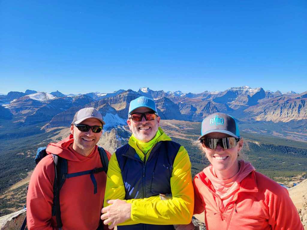
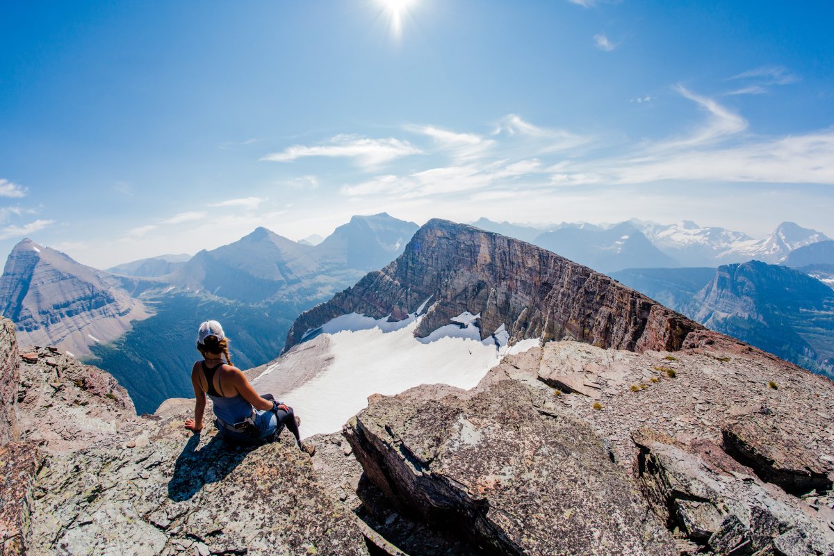
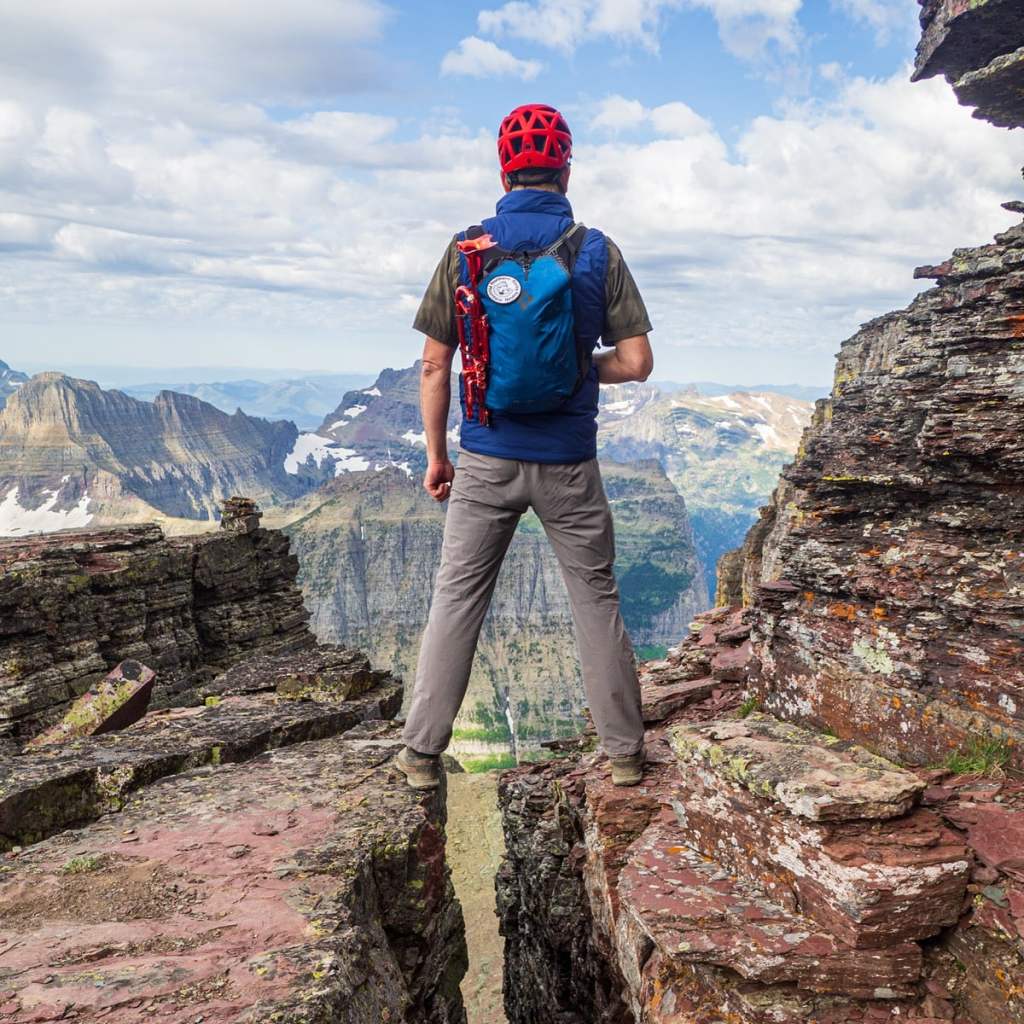
Congratulations, you made it to the summit! Now it’s time to head down to the trail head. This is the time for the highest risk of an accident. Your team is possibly mentally and physically fatigued, maybe even dehydrated. Help each other out with reminders on safety.
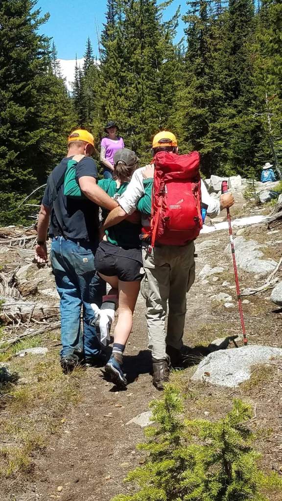
Did you make it back to the trail head? Most likely you did and it’s time to celebrate with a burger or pizza, and an ice cold beverage. Of course the Apres Climb choice of a burger versus pizza has historically been a close battle. But what if something went awry and, for example someone on your team broke an ankle? Are you prepared to self-rescue? I will leave you with this dilemma so you can mentally rehearse the many “what if?” scenarios you may encounter on a climb.
For me… I look forward to a greasy cheeseburger and a pint of scotch ale.
Hope is not an action plan!
Ken Rost