Same Places, Different Perspective… From the Air and from the Ground

10/13/2021

The mountains are calling and we must go… no matter how we get there! Although they are actually worth seeing from more than one perspective!

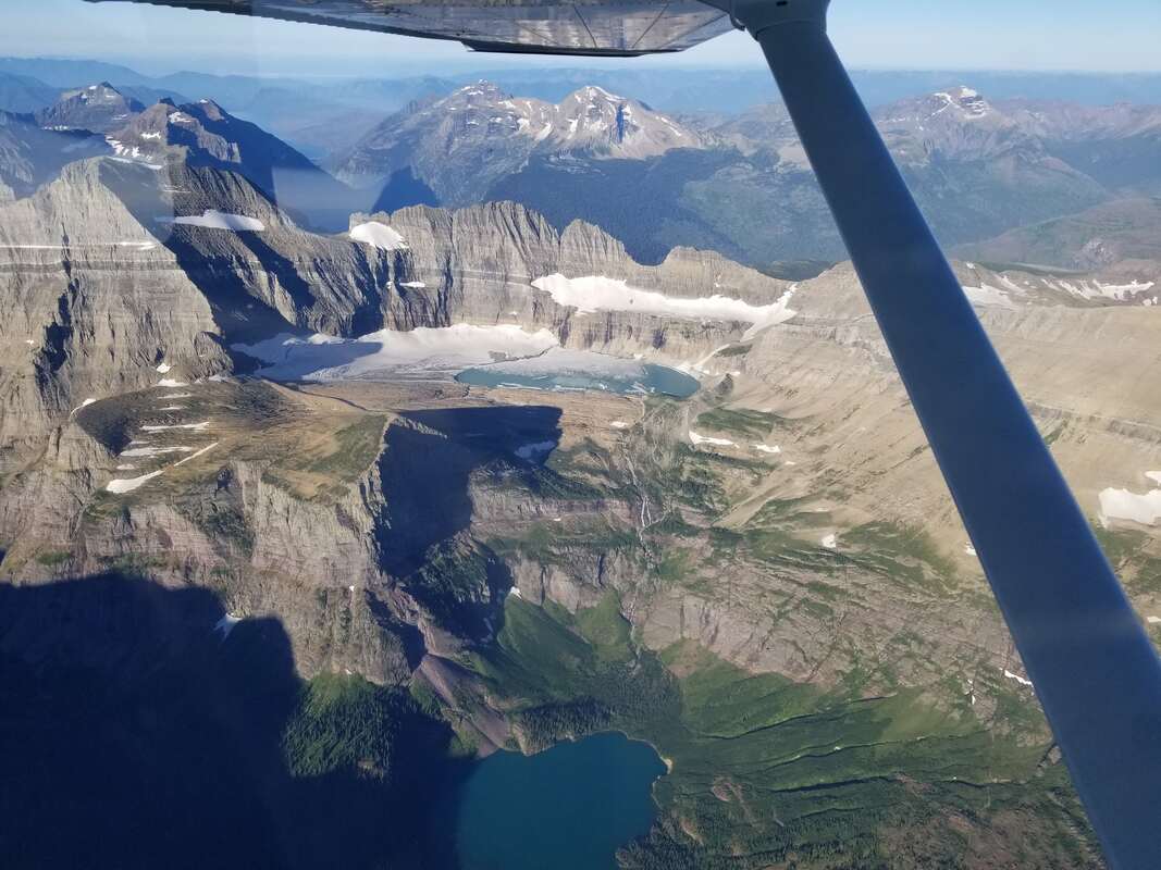
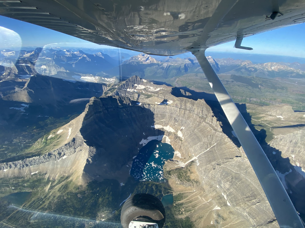
The 3D view from an aircraft provides a fantastic big picture of the area: its historical topography, its bearings (situation awareness)… its grandiosity. It’s also a much easier way to visit; almost like viewing it from a couch.

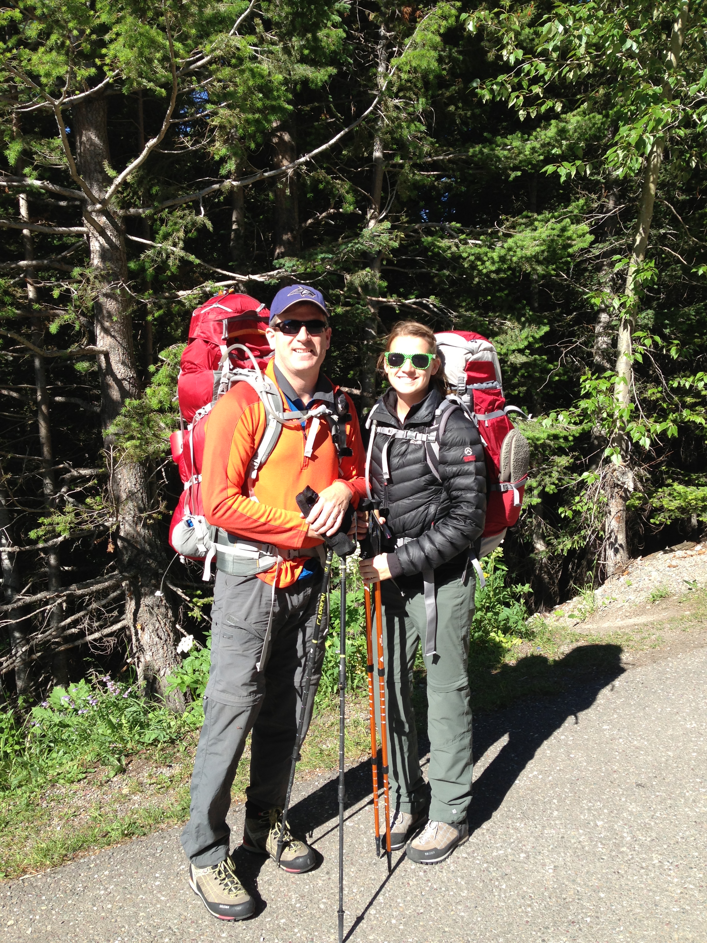
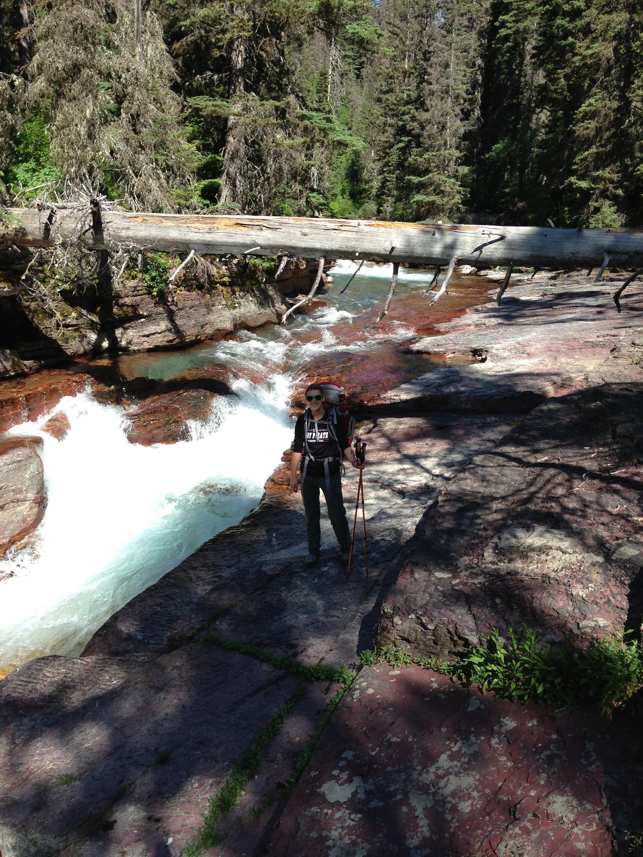
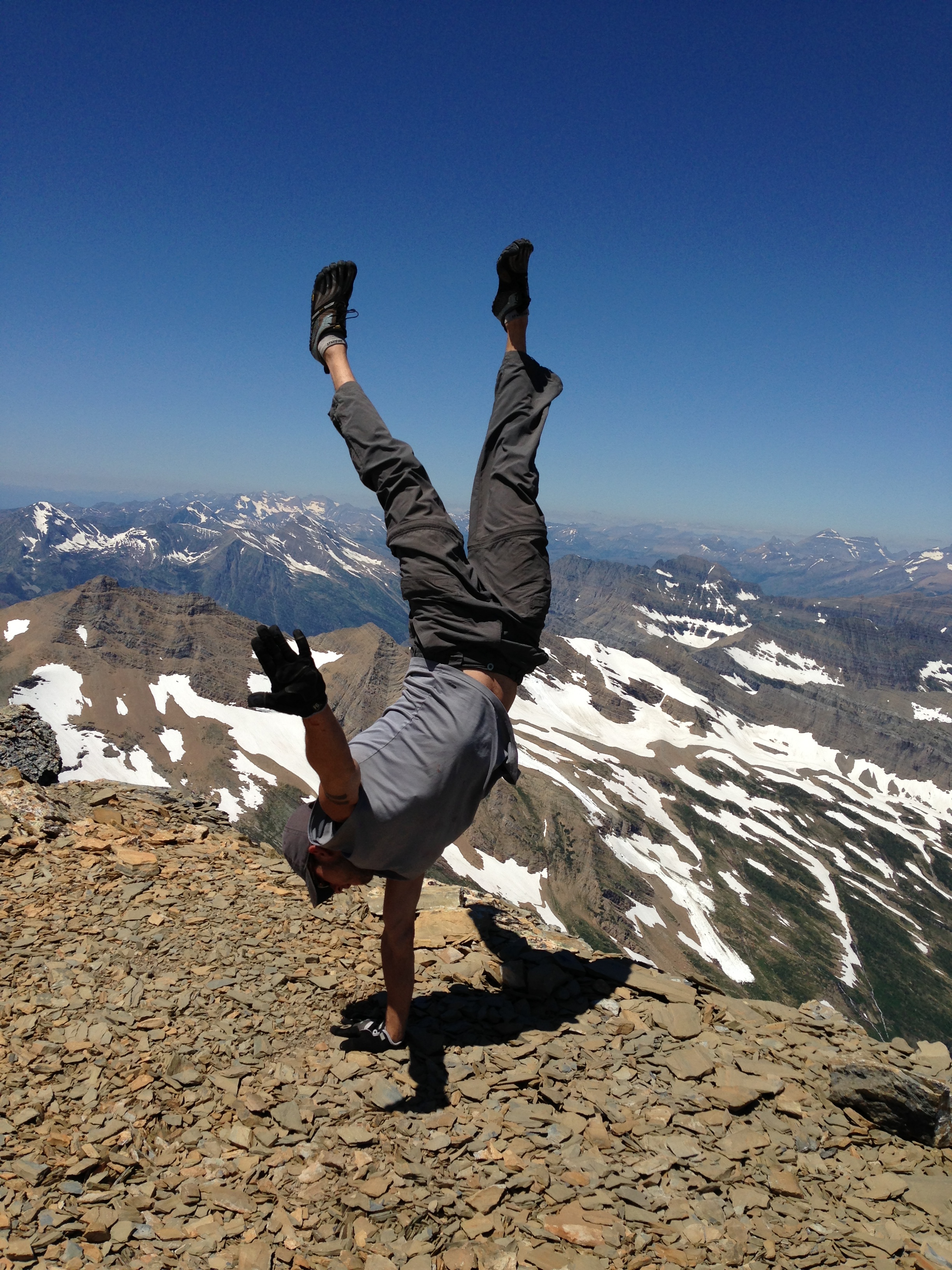
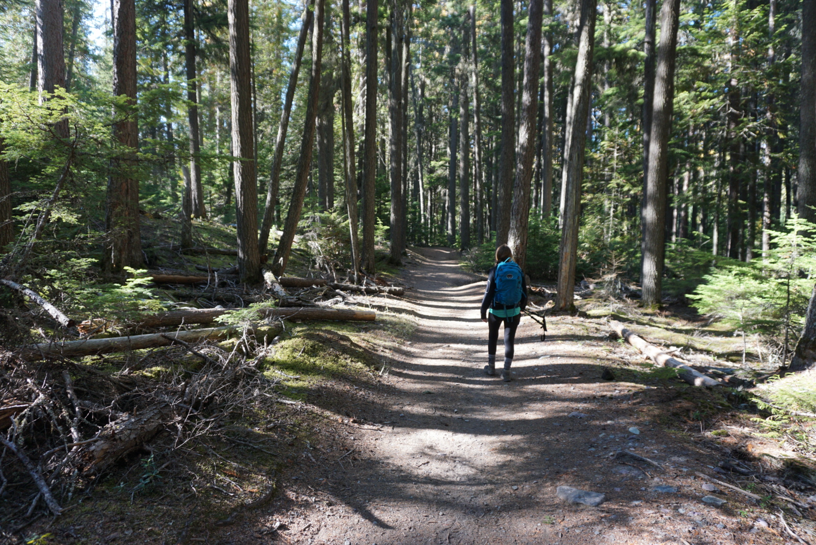
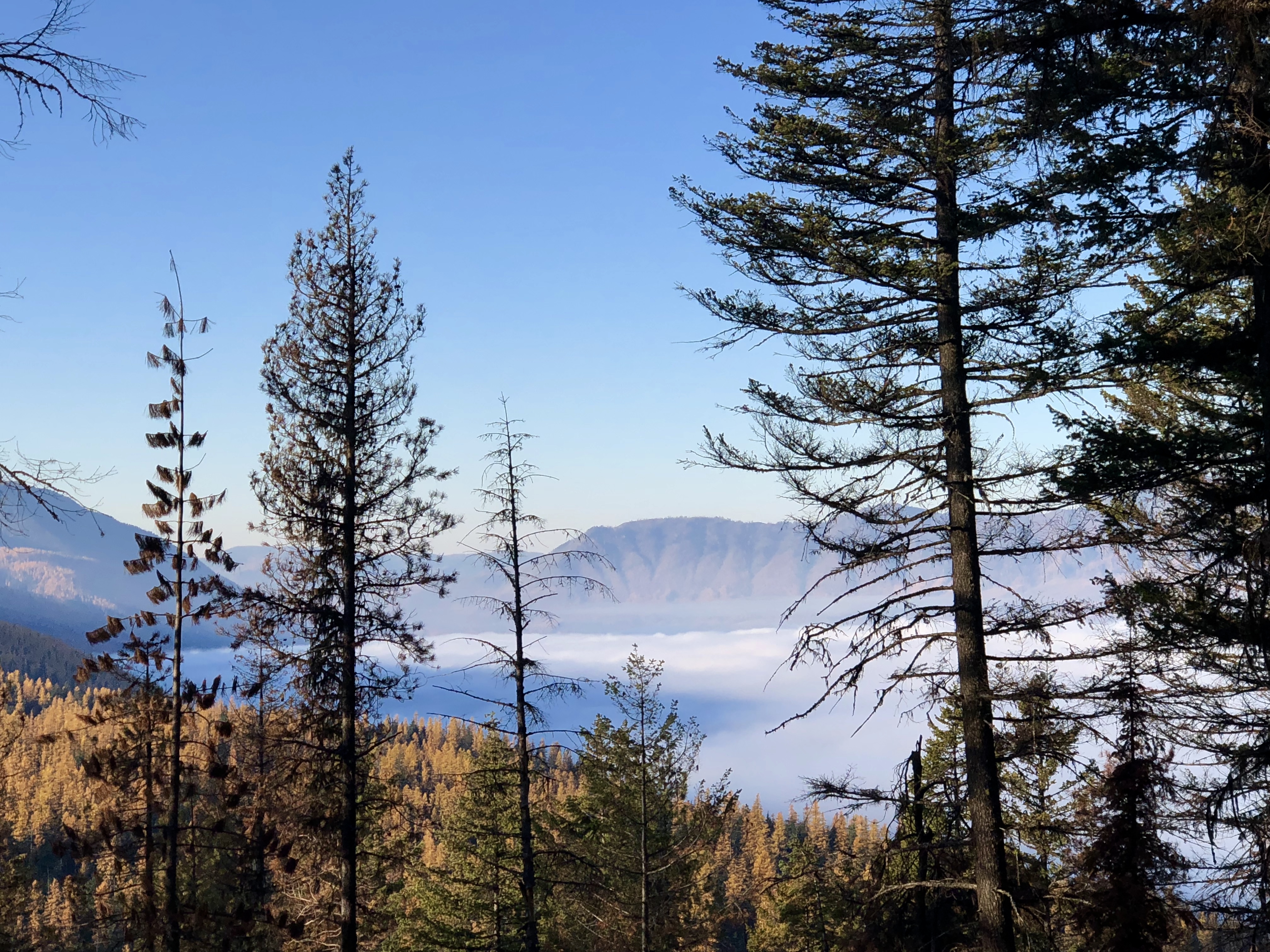
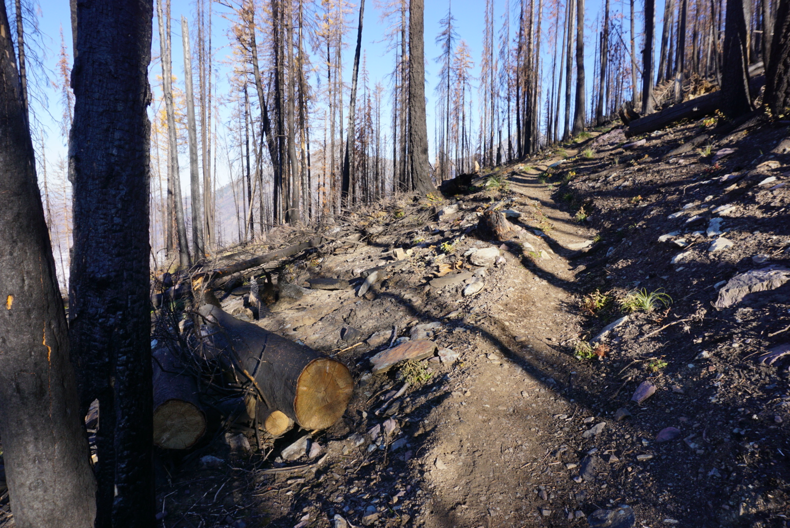
However, stepping foot on the trails feels like being a part of the mountains; an extension of them! Hiking through and over the mountains is a great feeling for me. I love the experience, being in nature, disconnecting from everyday life, the exercise, the challenge, the views, the smell, the ability to stop at any moment and, yes, the wild animals even though I prefer to see them from a good (safe) distance.

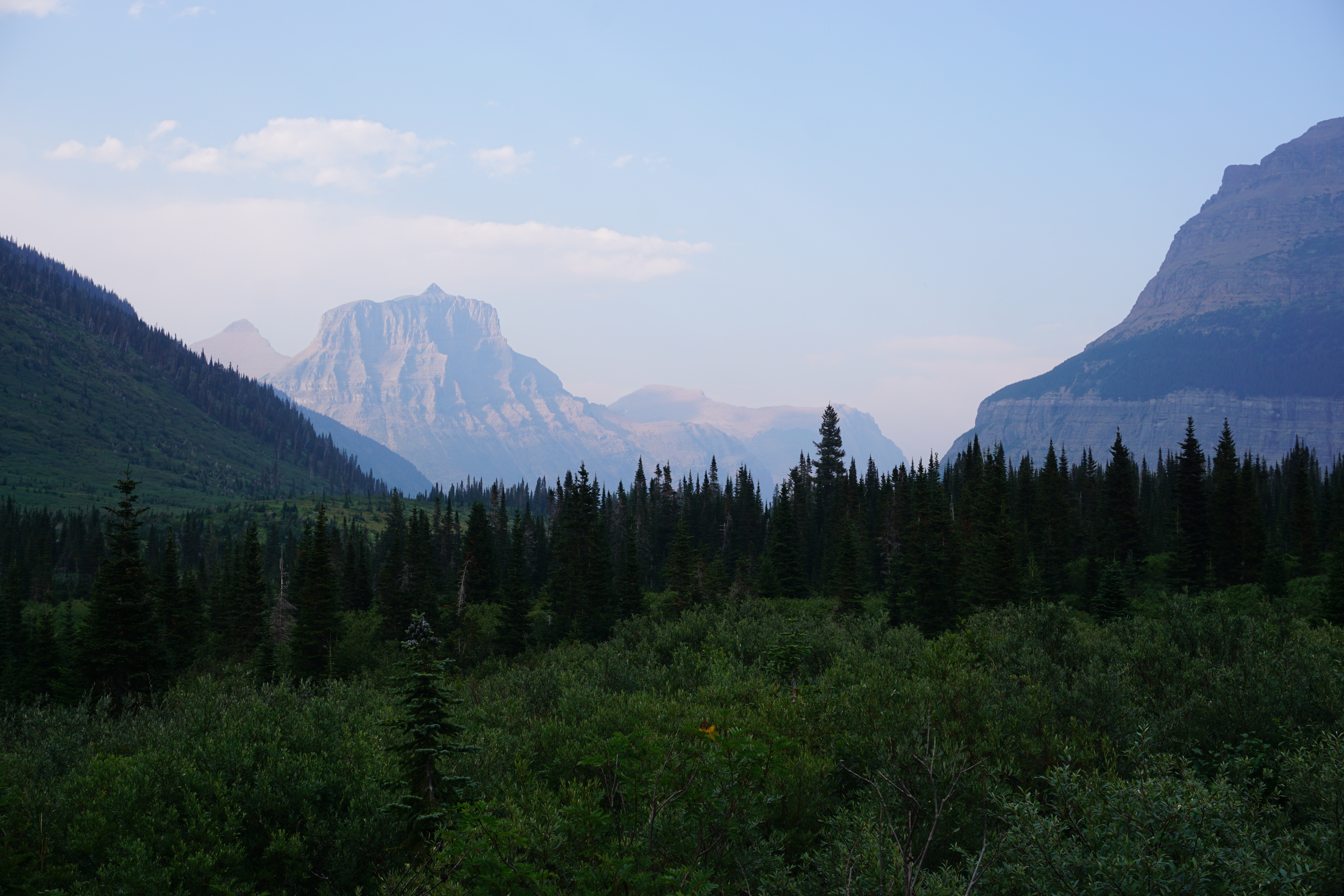
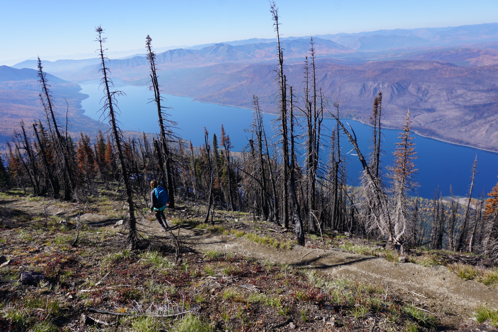
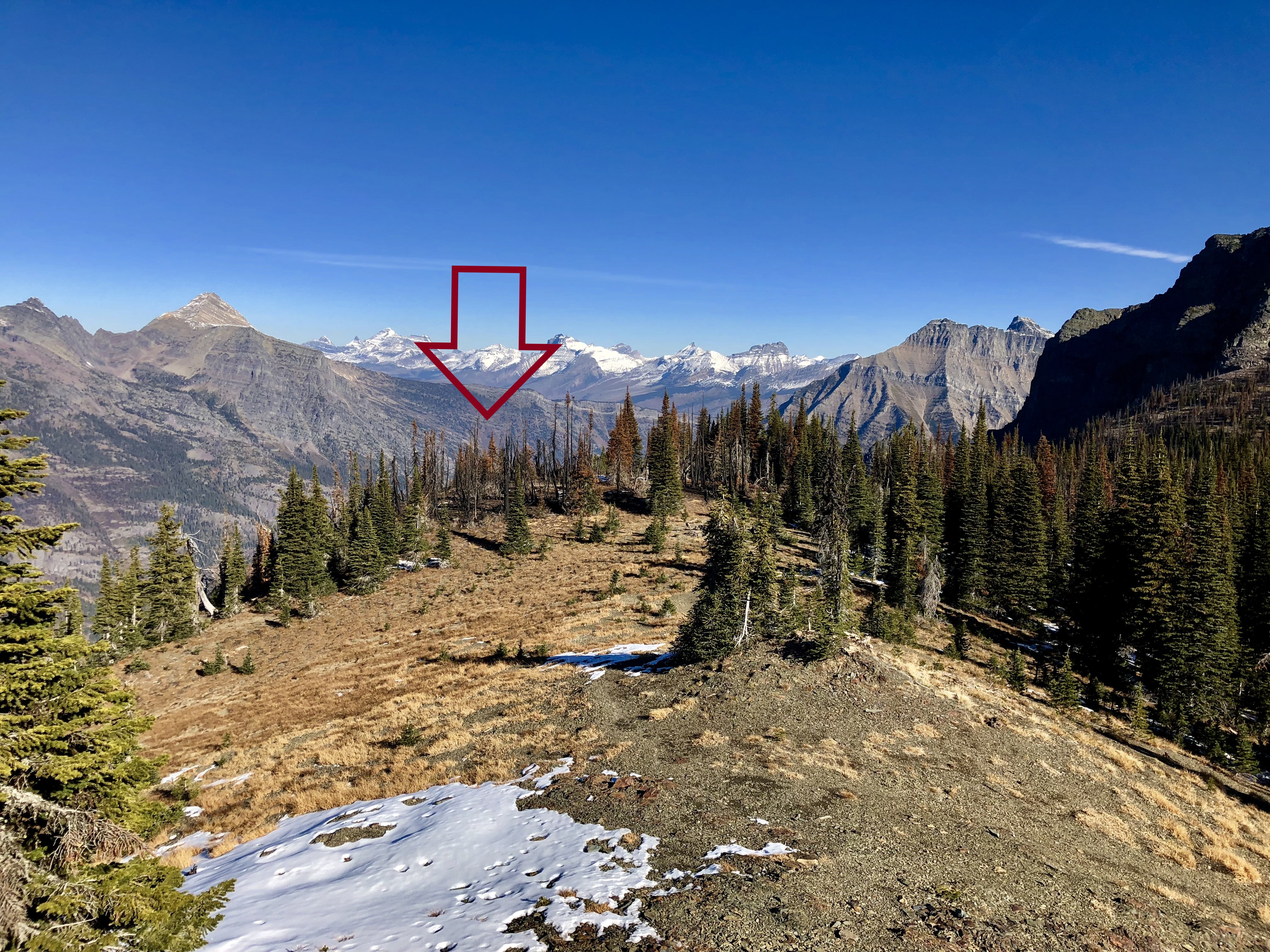
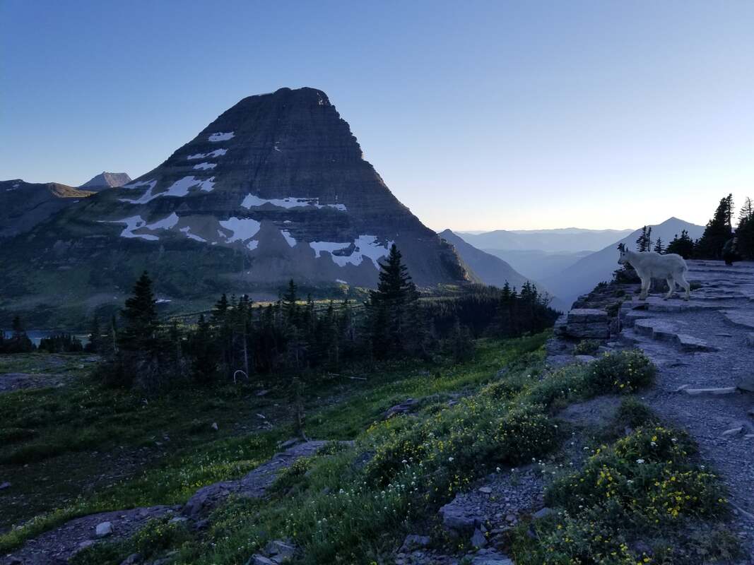
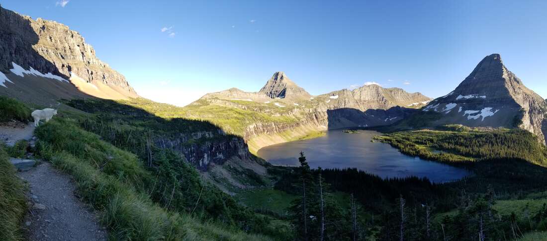
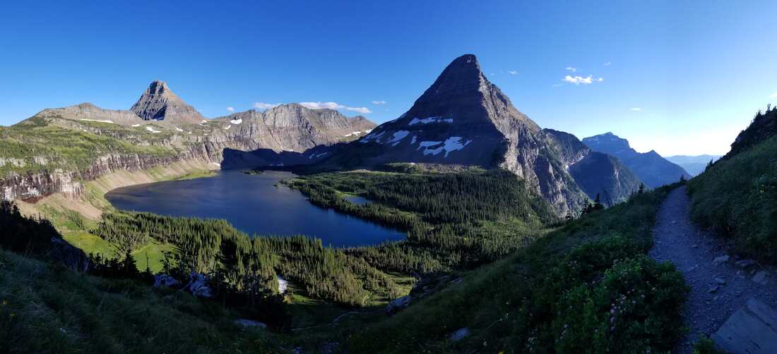
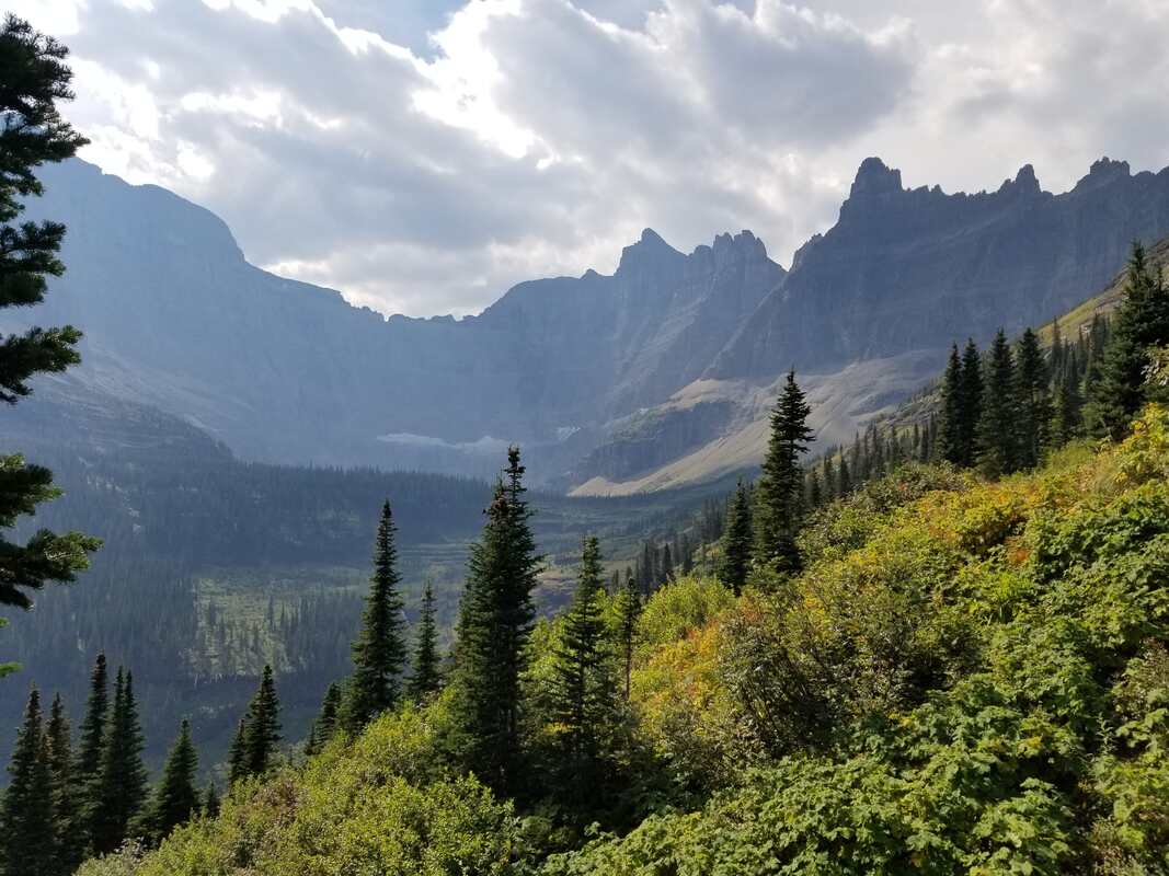
​Let’s use a few examples from Glacier National Park to explain further. (Note that some of the aerial and ground pictures are from two different summers.) I’ll start with Hidden Lake, one of Glacier’s easiest and most popular hikes from Logan Pass.

Picture

While one cannot see Logan Pass, you can picture it just south of the lower left corner of the picture. From there, one can follow the trail (partially paved and can be seen in the picture) to view Hidden Lake and its beautiful valley. The aerial view provides a great shot of it and its general area, including Sperry Glacier in the immediate distance.

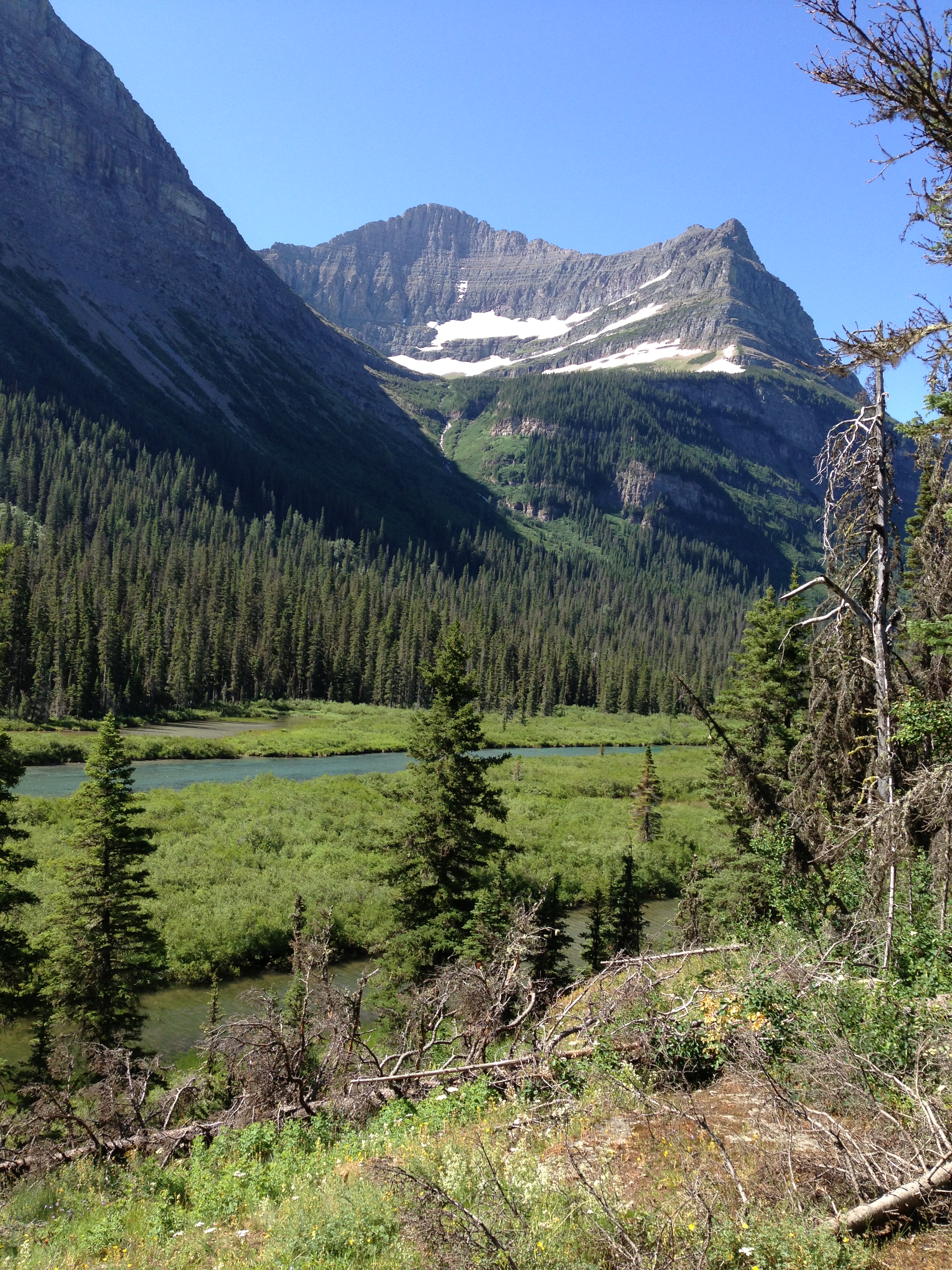
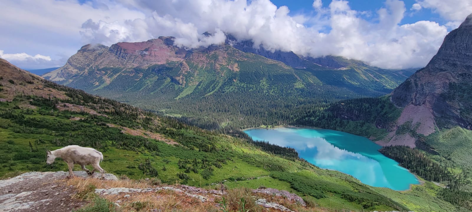
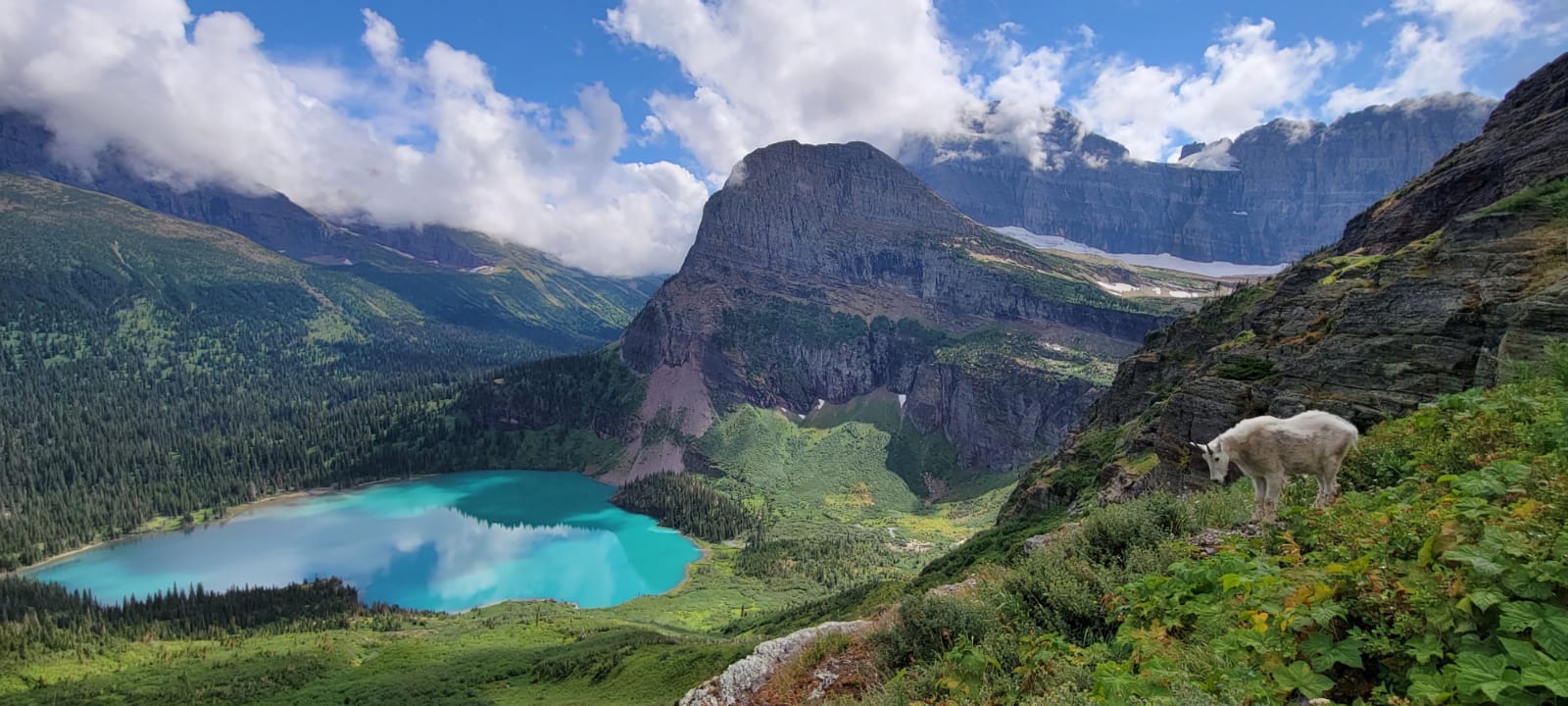
However, being on the trail allows you to be a part of the landscape. It puts you right in the middle of it all but does not provide views of the area beyond the valley. It’s also not uncommon for mountain goats to be enjoying this same beautiful area as hikers. Unfortunately for some though, this trail is often closed due to “bear activity.” In this case, it means bears chasing mountain goats up and down the valley, left and right of the trail.

Picture
Picture
Picture

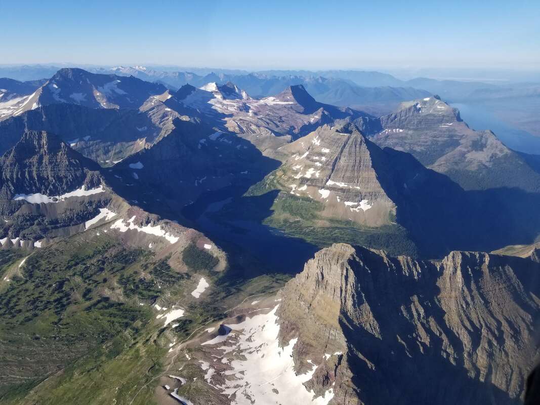
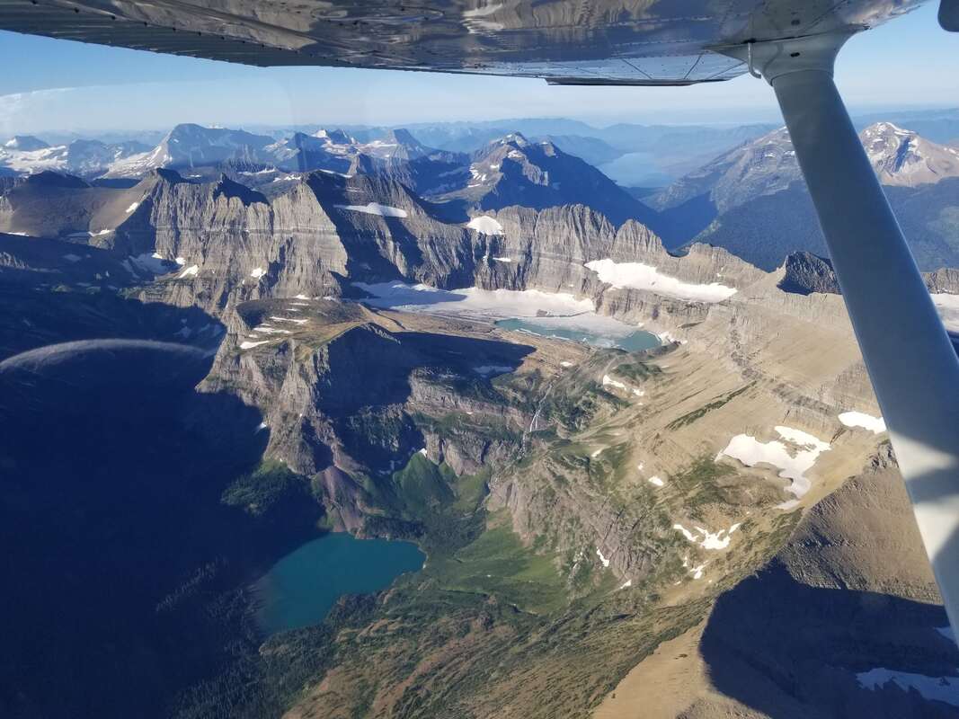
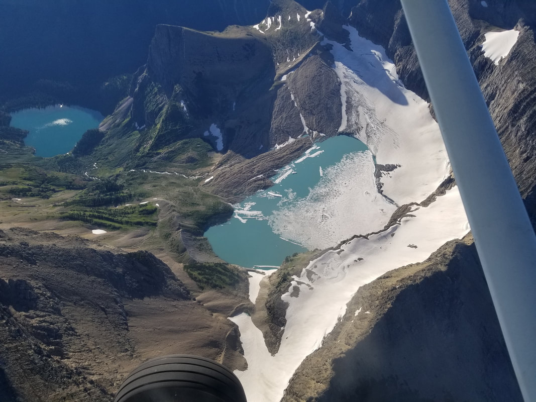
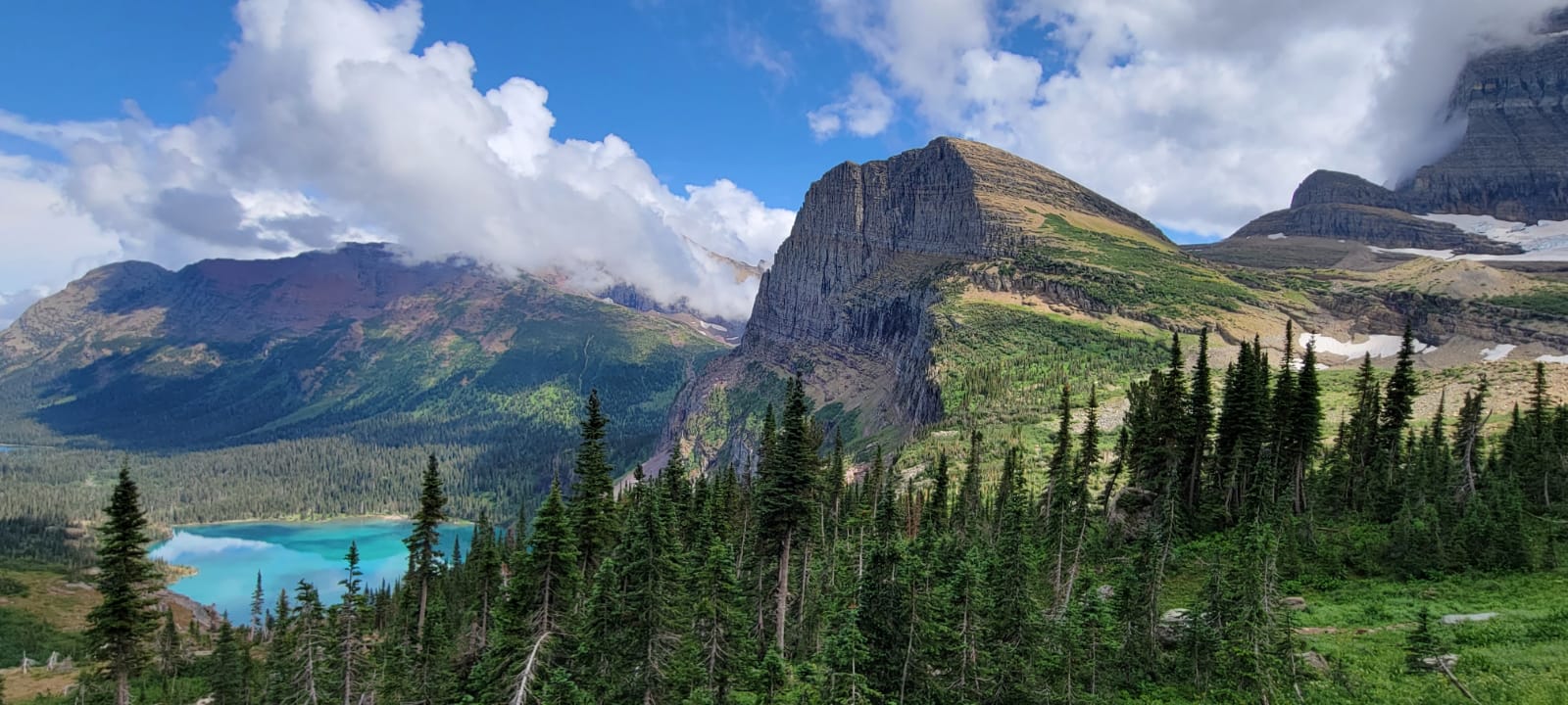
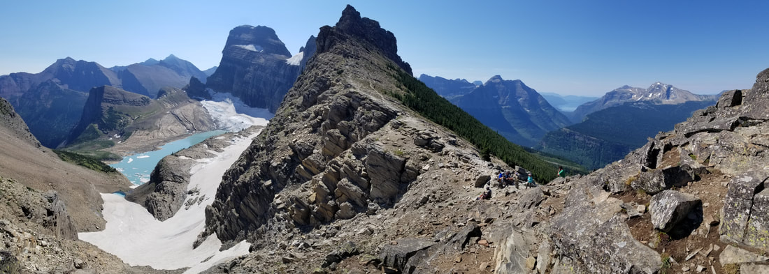
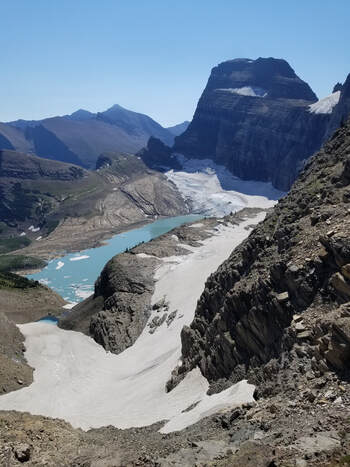
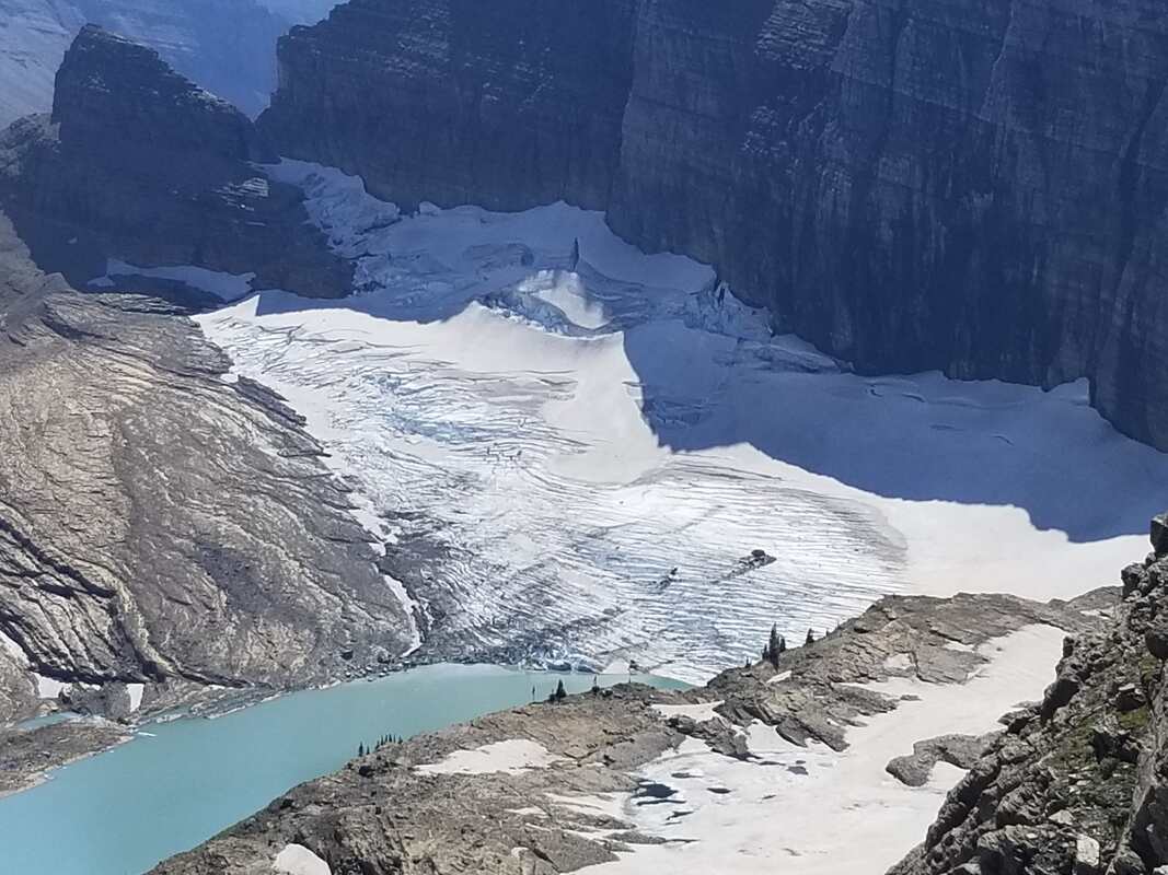
Continuing with famous trails… Grinnell Lake and Grinnell Glaciers are amongst visitor favorites. The hike to the lake is fairly easy, especially if shortened by taking a boat across Swiftcurrent Lake and another one (part of the same ticket) across Lake Josephine. But the hike to the glacier is moderate.

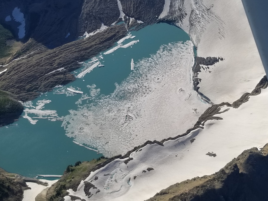
Flying over the area clearly shows the difference between Grinnell Lake and Grinnell Glacier. Many first-time visitors question this because they think Grinnell Lake is the one on top, when it’s the one at the bottom. The lake up top is simply part of the glacier that is melting and receding.

Picture
Picture
Picture
Picture

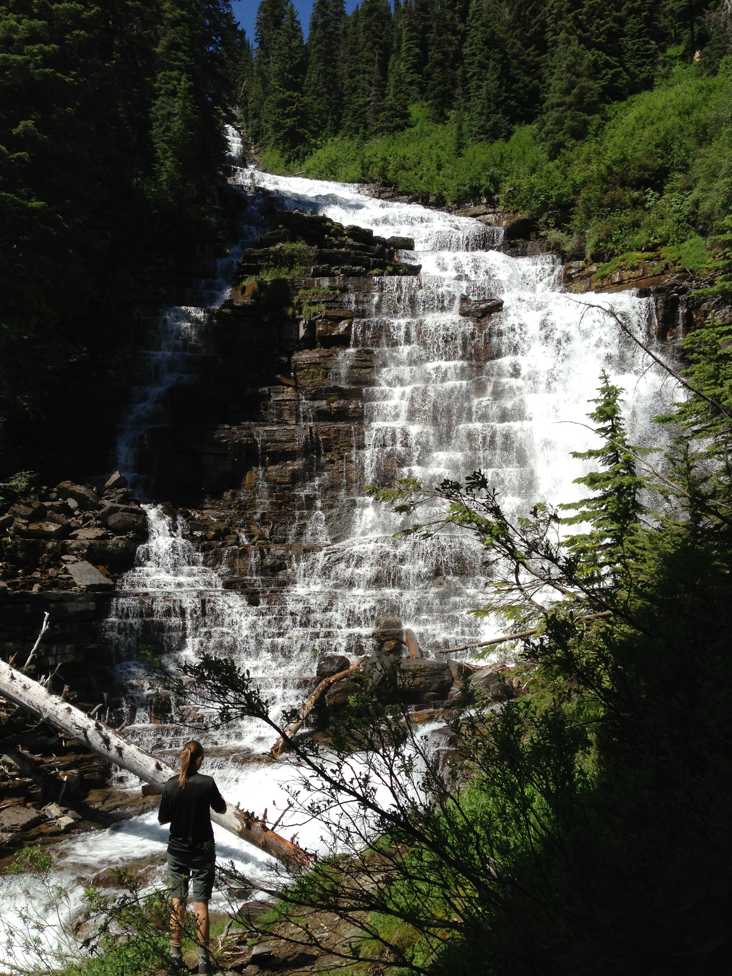
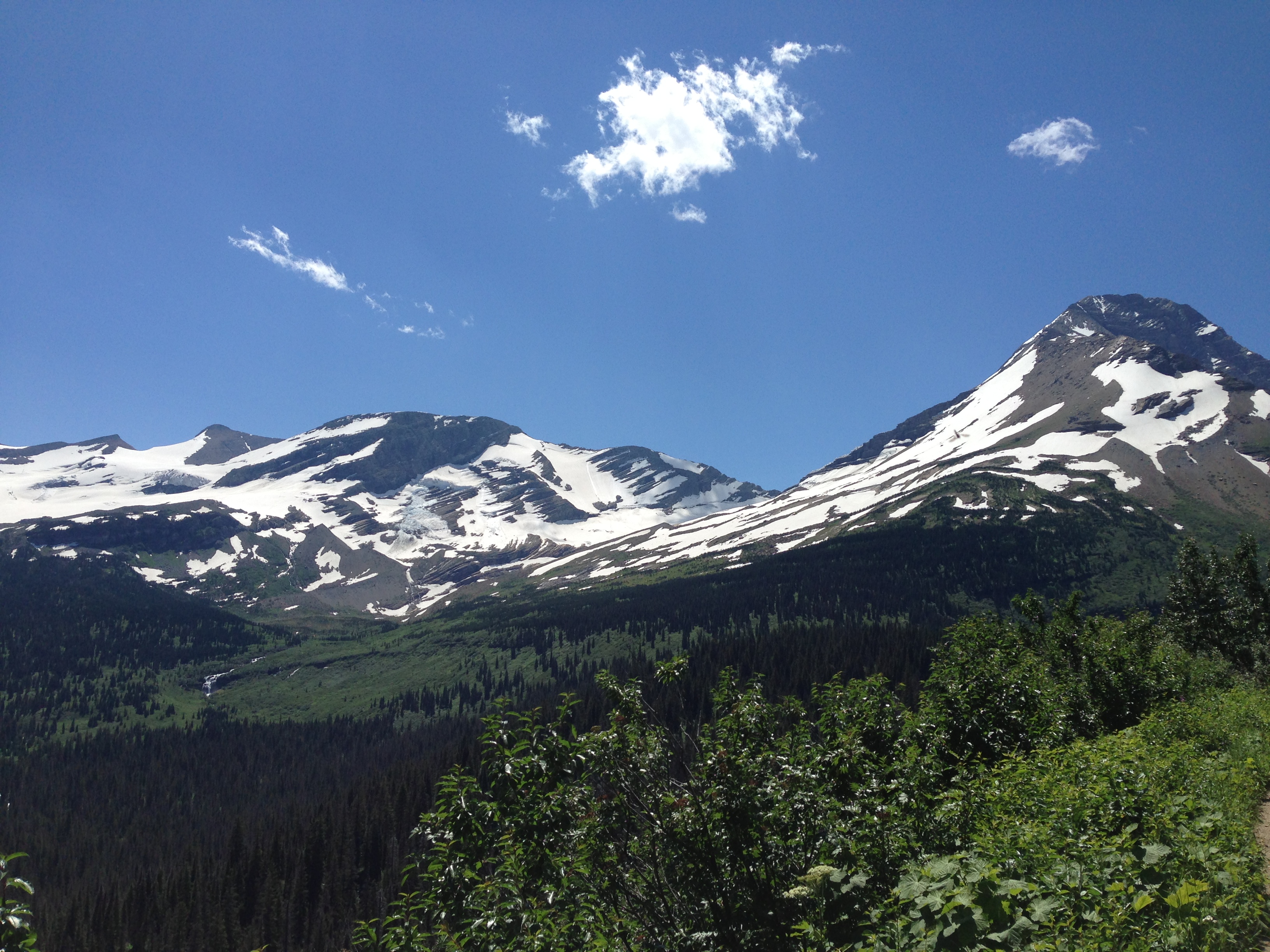
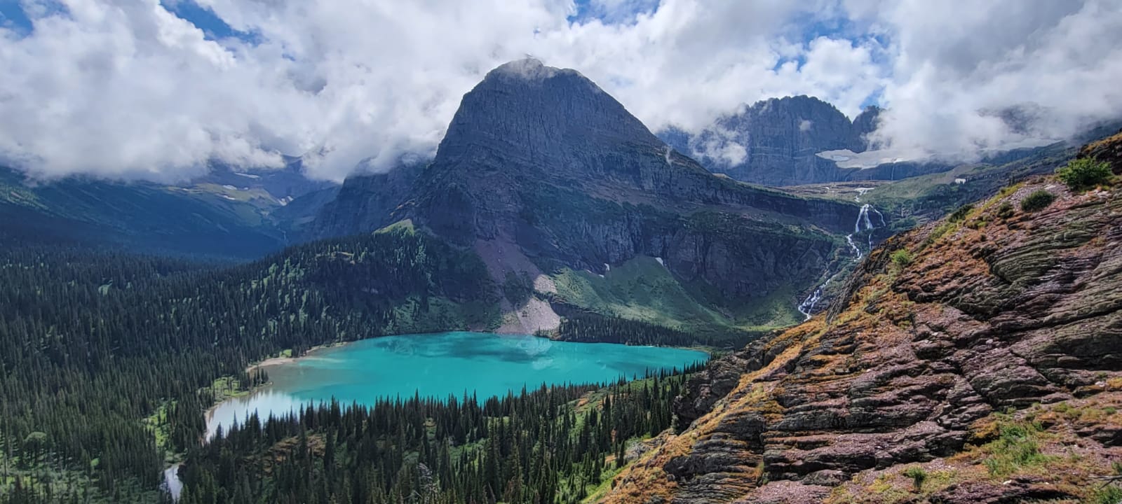
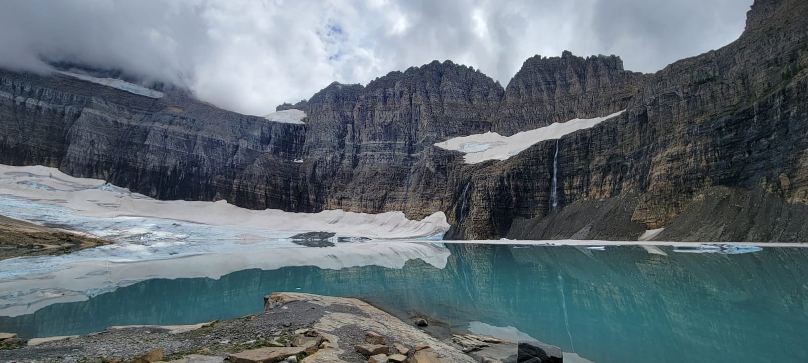
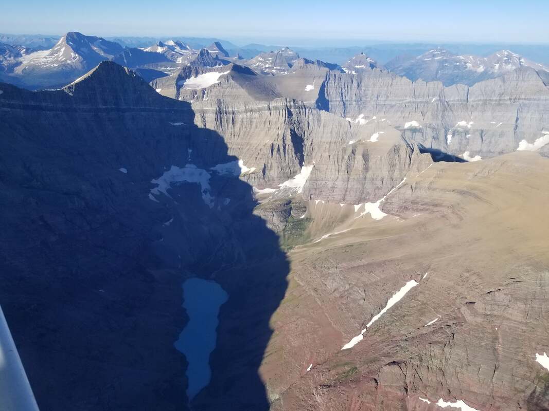
One of my first thoughts when hiking to the Glacier was that the waterfalls were not as evident from the air as they were from the ground. My second thought was that the Angel Wing (the mountain west of the waterfall) is much bigger in actuality than the flight portrayed (even with the shadow). I still would have liked to hike up to it, but it was pretty rainy and stormy when we arrived at the Glacier so it’s on the list again for a future trip.

Picture
Picture
Picture
Picture
Picture
Picture

​We could have never seen a ram this close or this good from any aircraft.


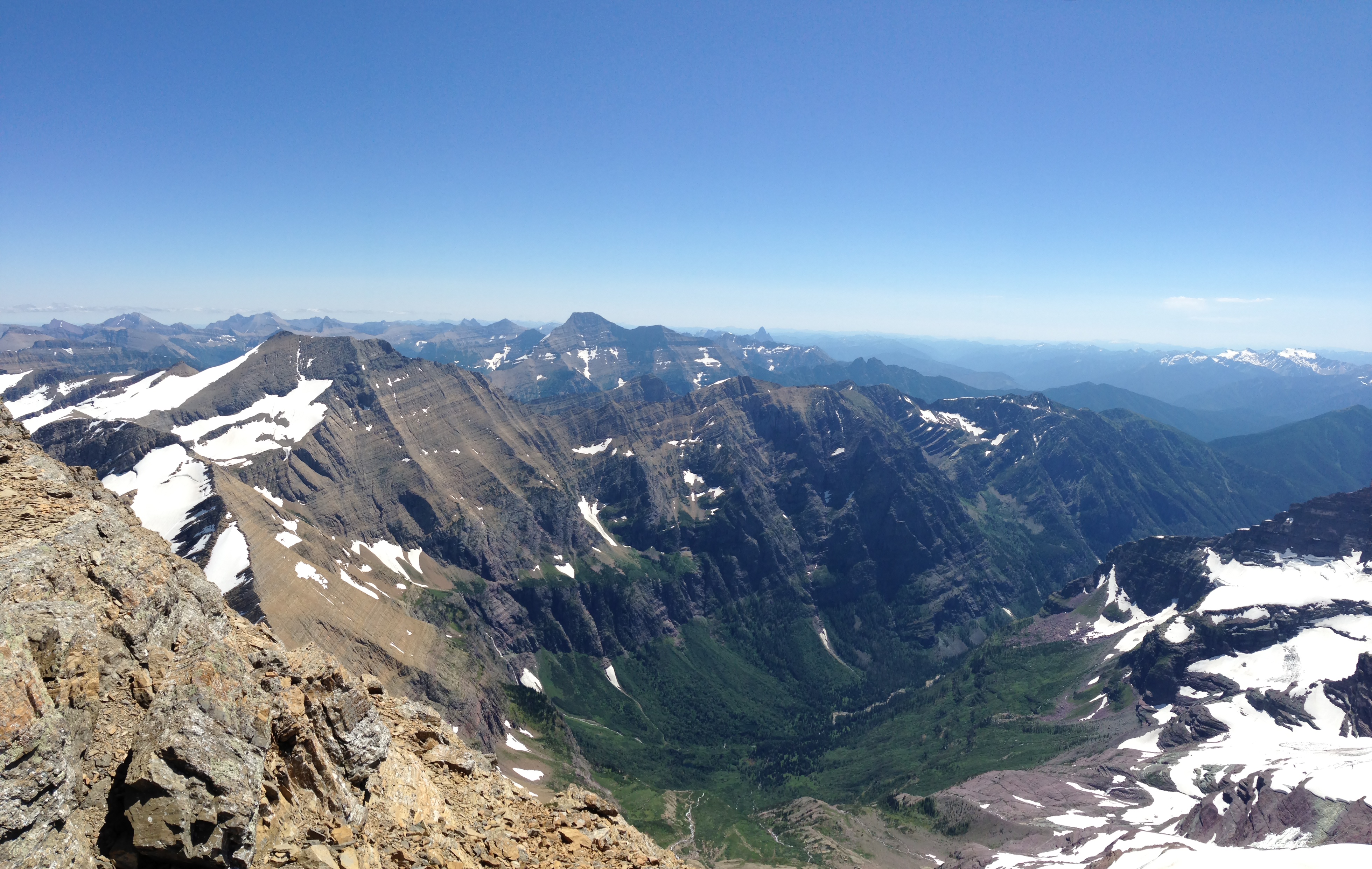
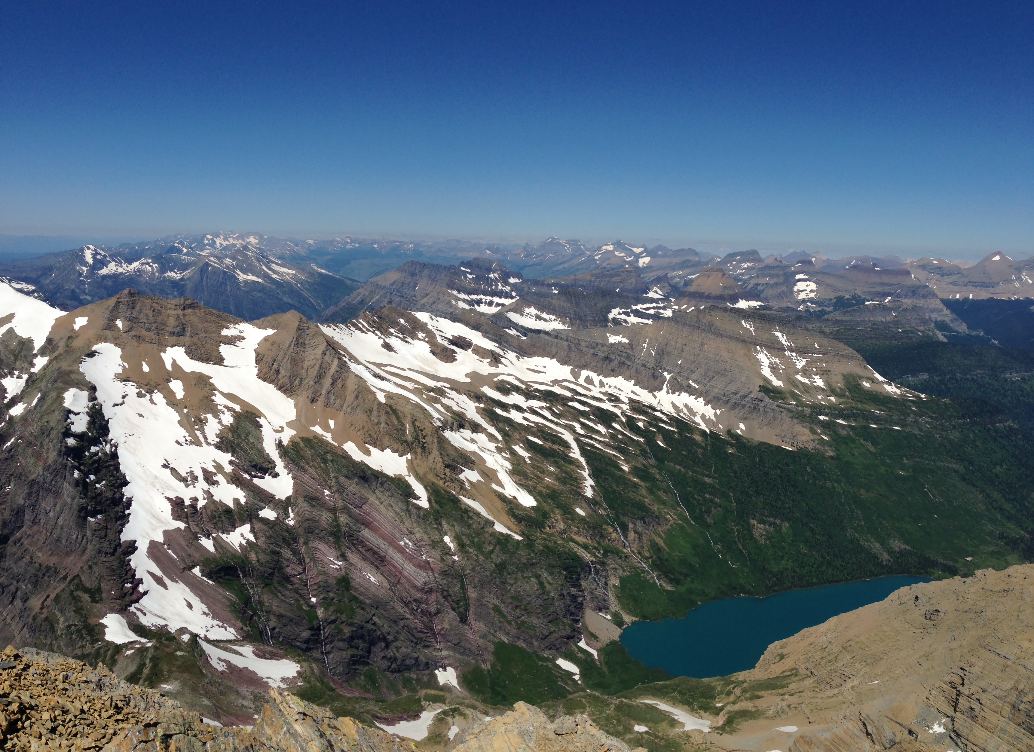
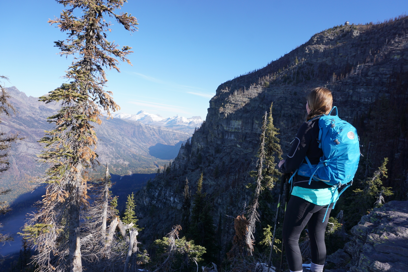
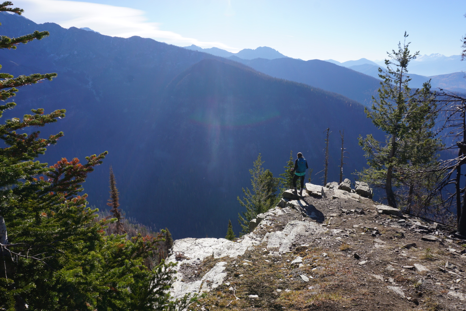
Hiking directly to the Glacier isn’t the only way to view the Glacier from the ground. The Highline Trail, also from Logan Pass, has a steep Grinnell Lake Overlook side trail (which may be scary to those afraid of heights), giving hikers a completely different viewpoint. One can look down onto the Glacier. This is the longest of the hikes discussed but it’s also one of my favorites.

Picture
Picture
Picture

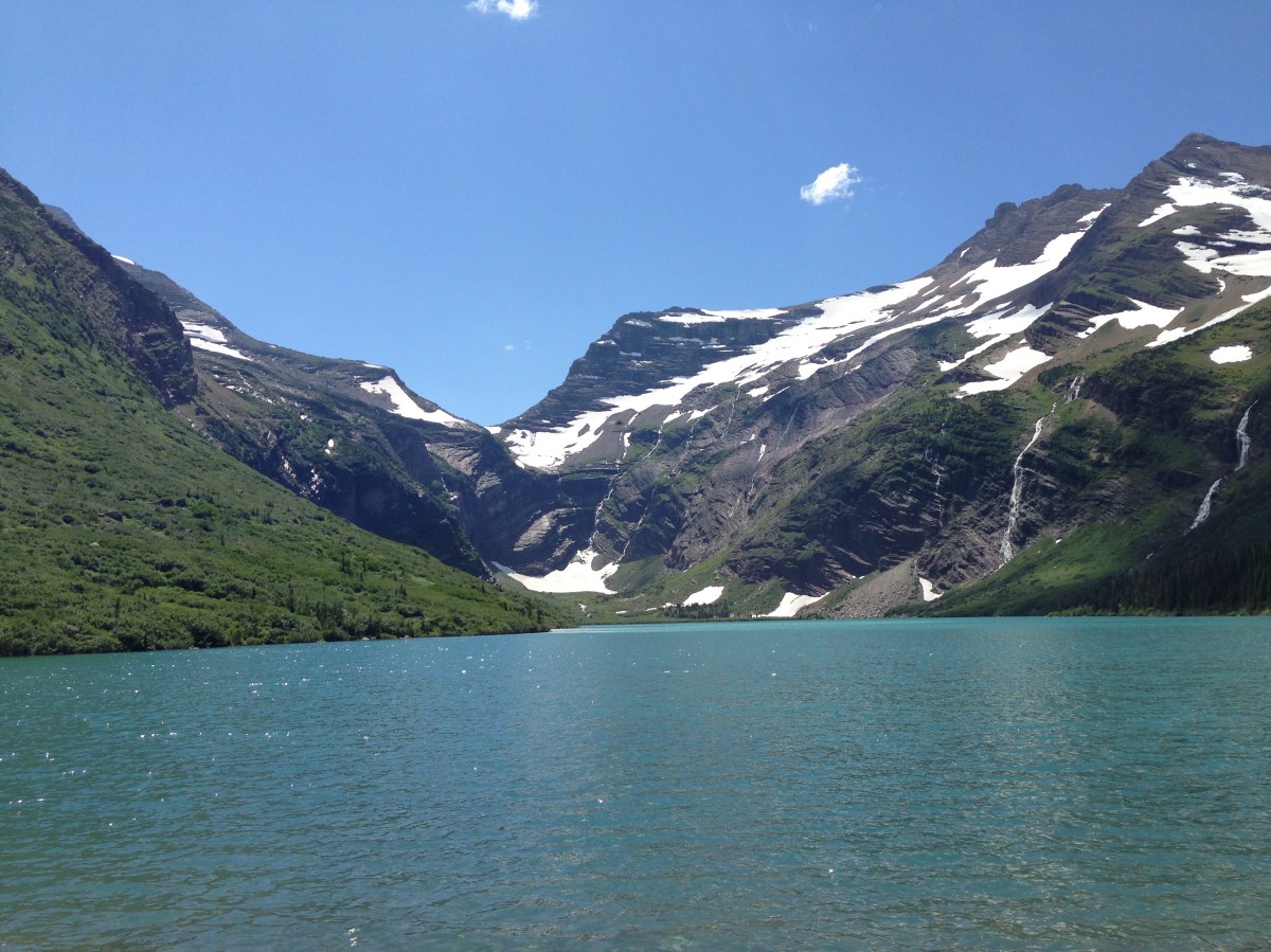
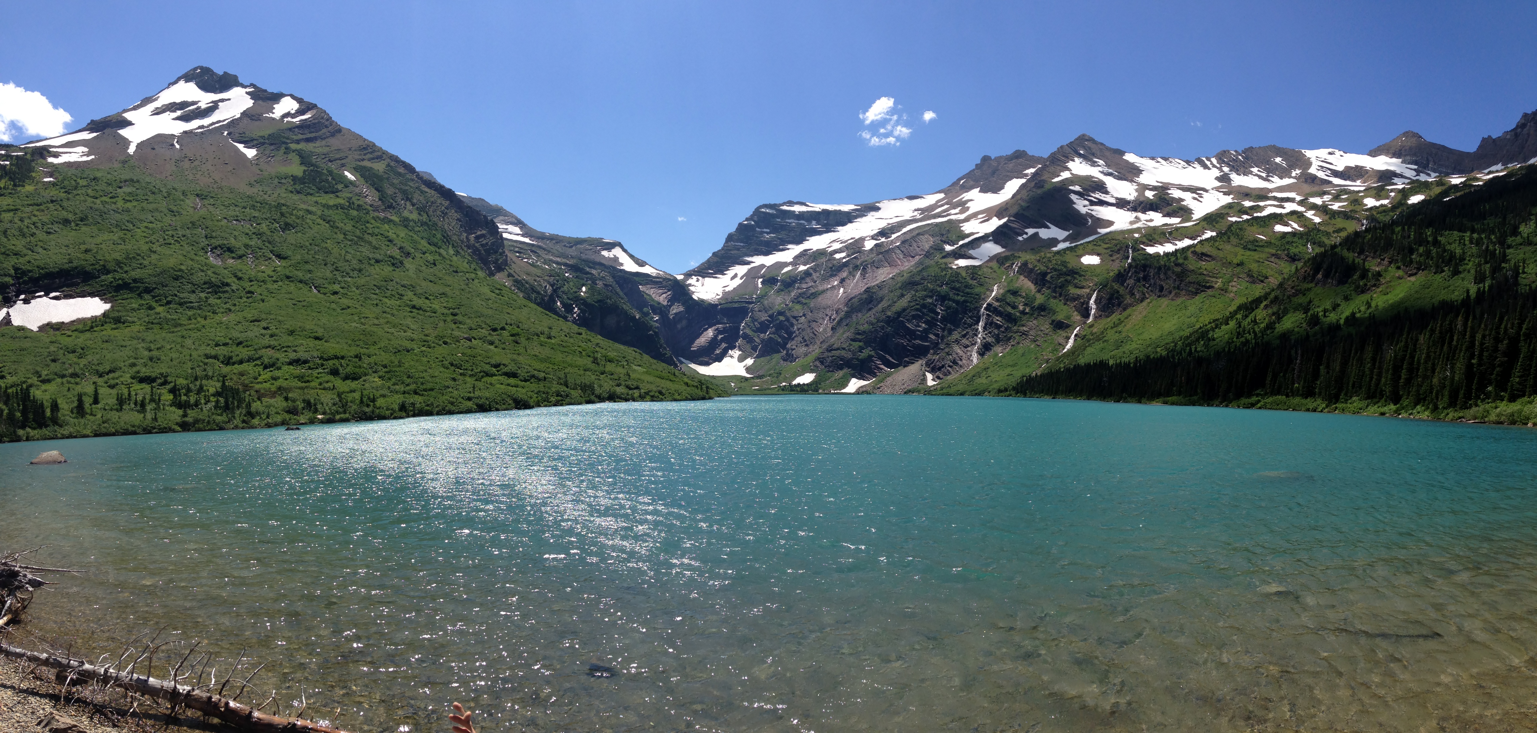
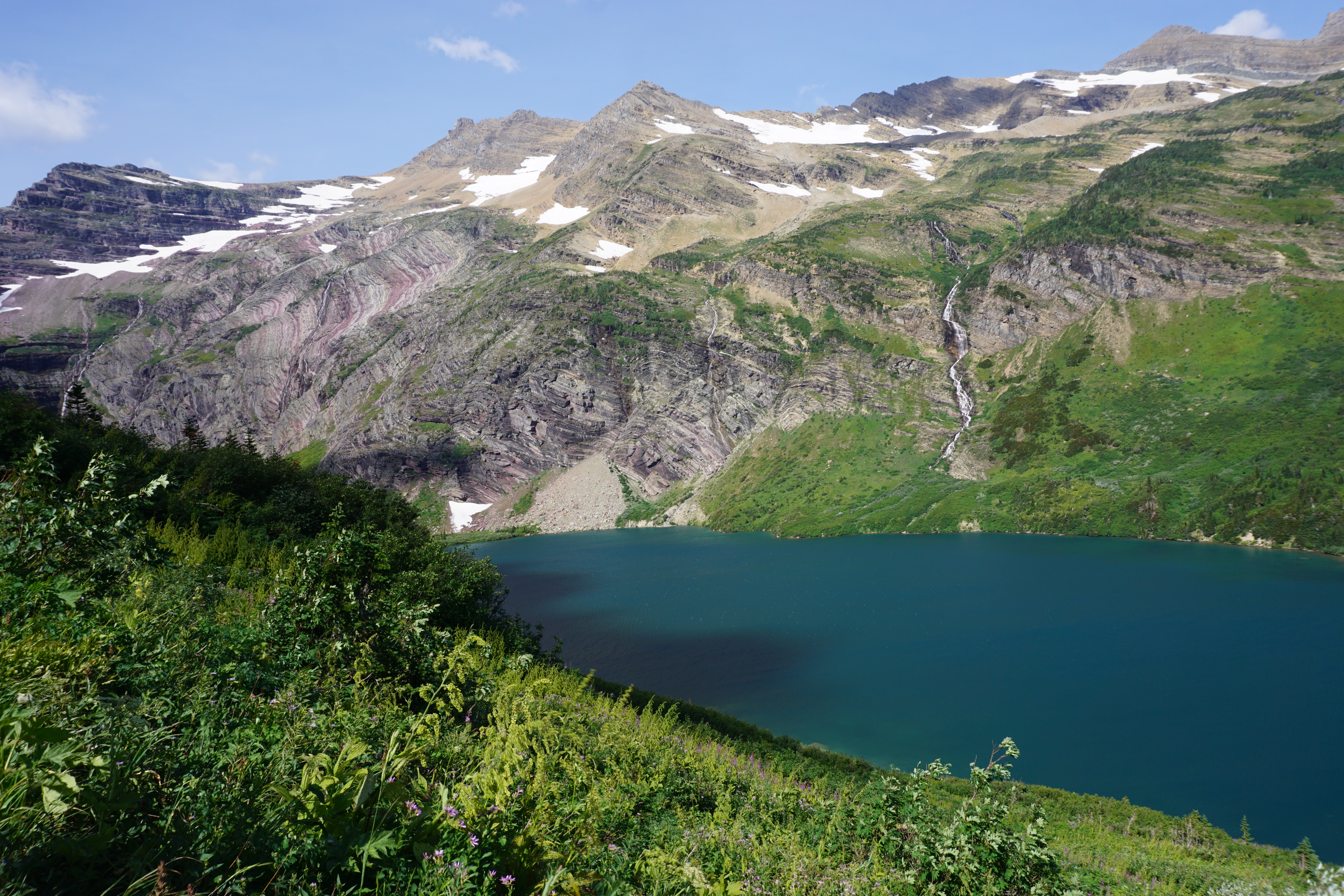
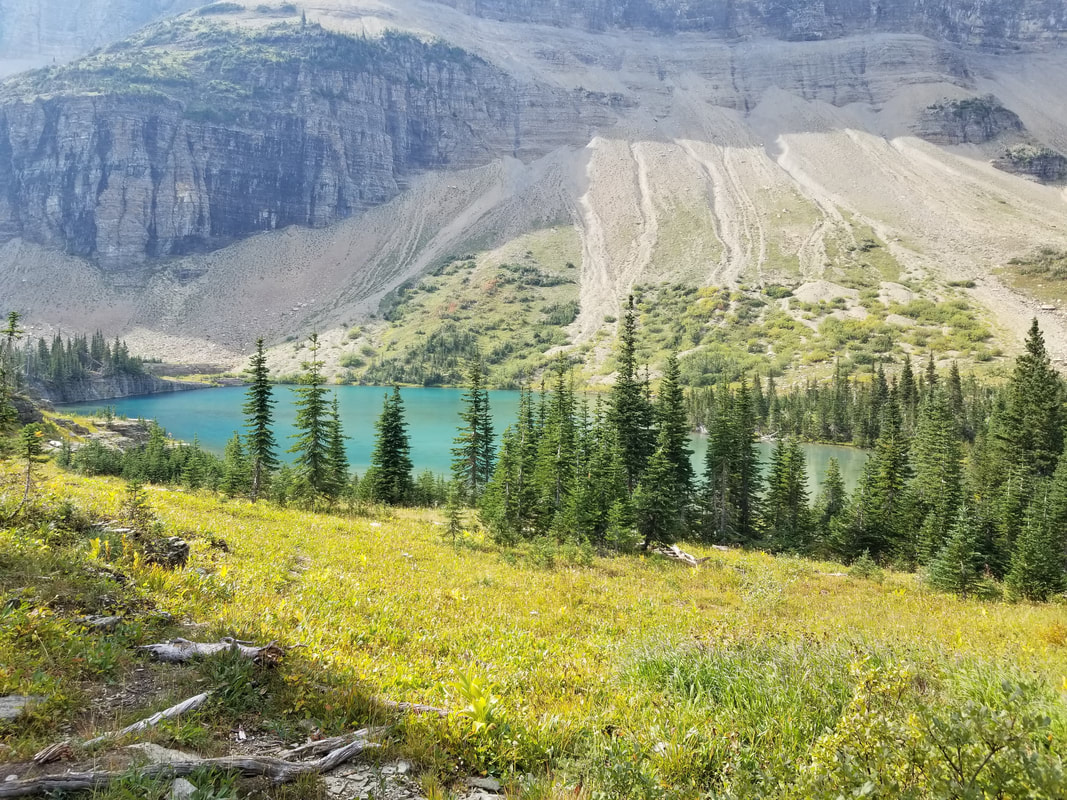
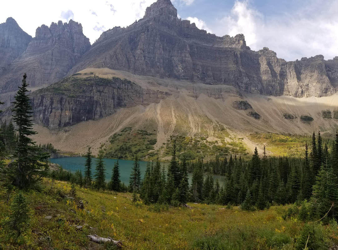
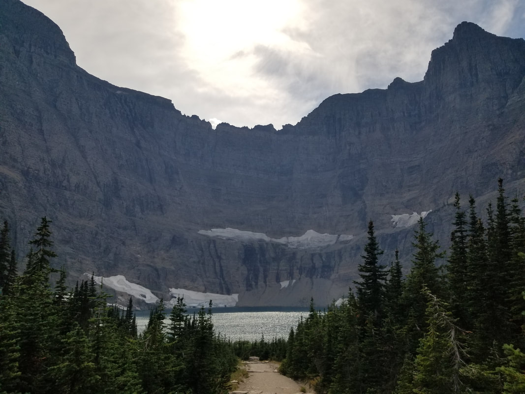
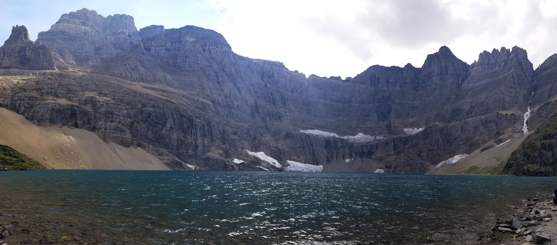
One of the reasons I enjoy flying over the mountains is to scout my next adventure. This was the case with Iceberg Lake. I loved the way the lake looked from the air, with its deep blue color and being surrounded by sheer glacier walls.

Picture
Picture
Picture
Picture
Picture

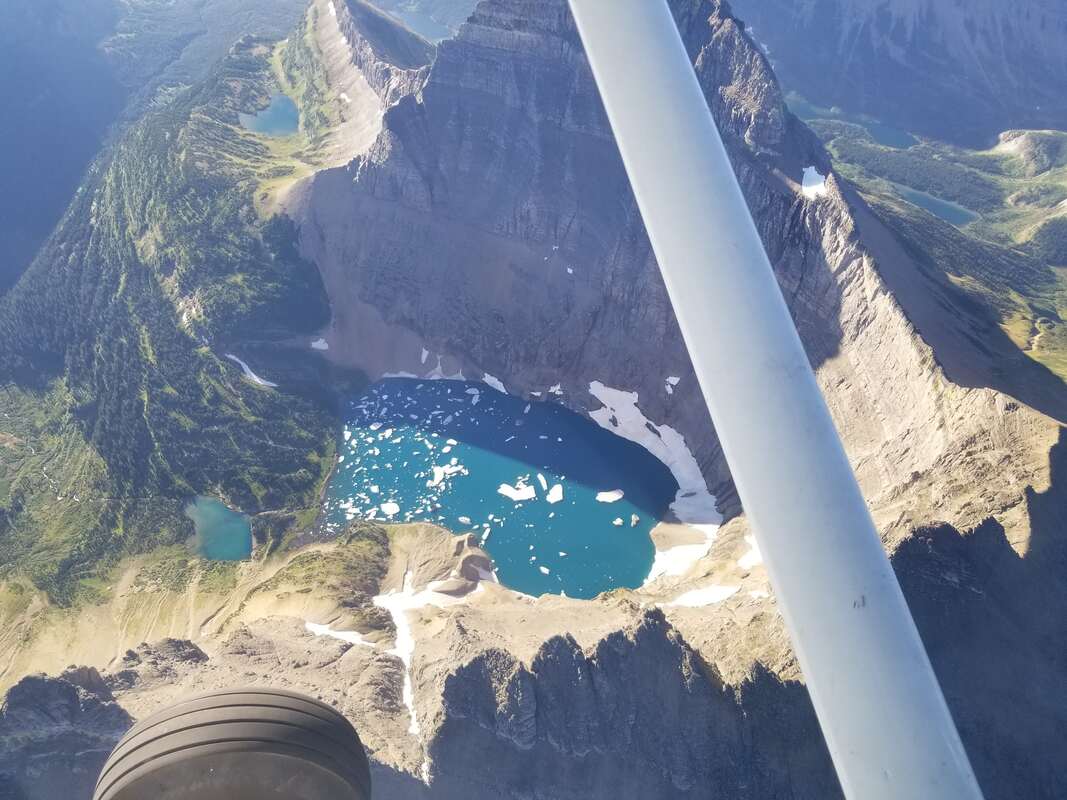
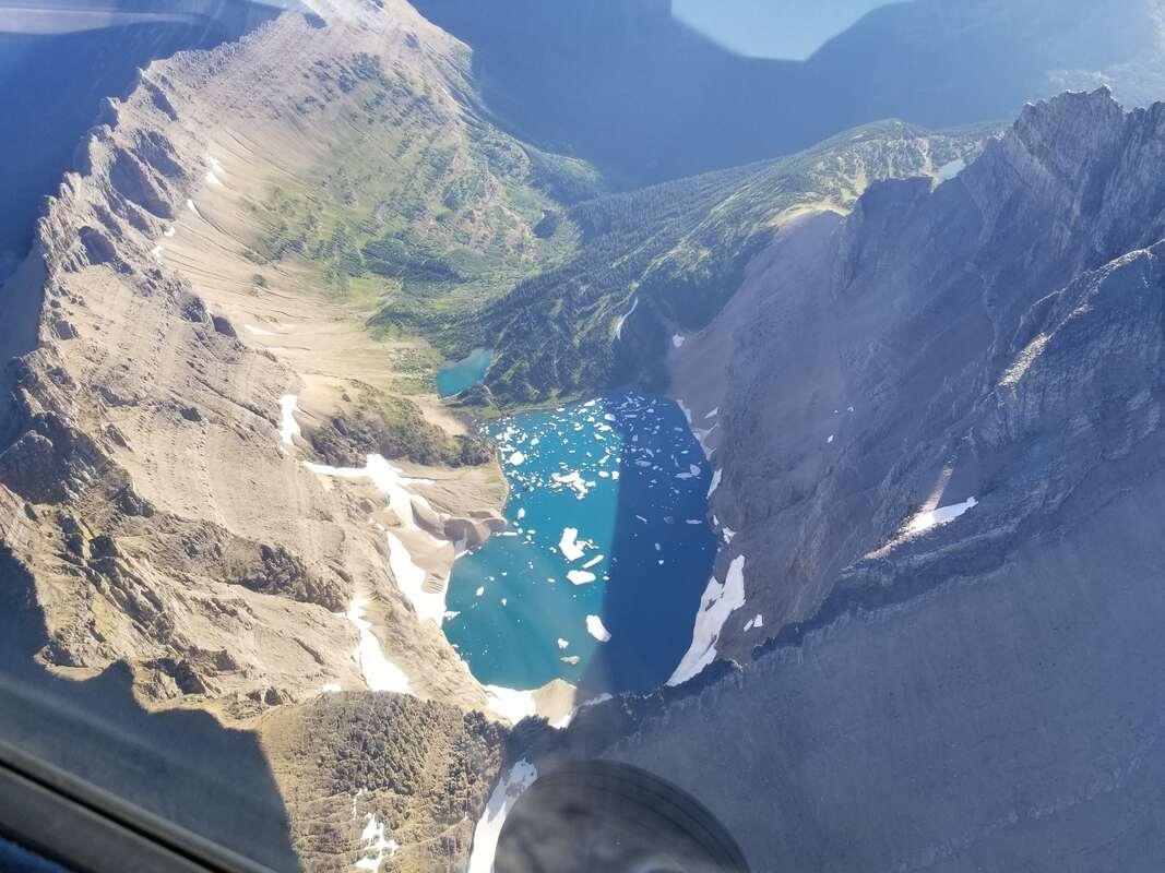
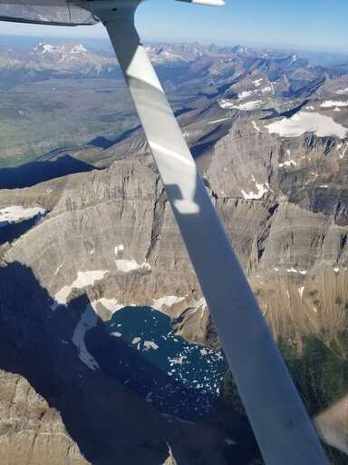
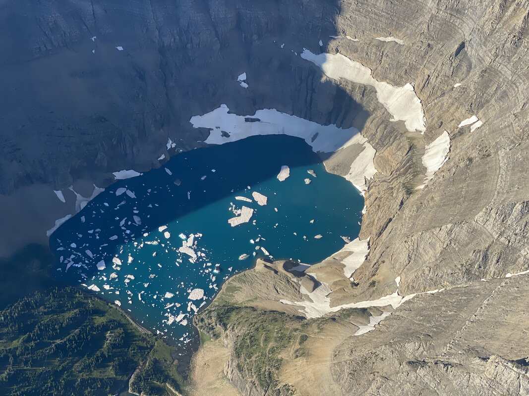
The sheer walls were honestly just as impressive, but in a different way, flying or hiking. Seeing their vertical nature from the air was impressive and seeing their rugged look up close from the trail was spectacular as well. My mom hiked it with me, making it even more special.

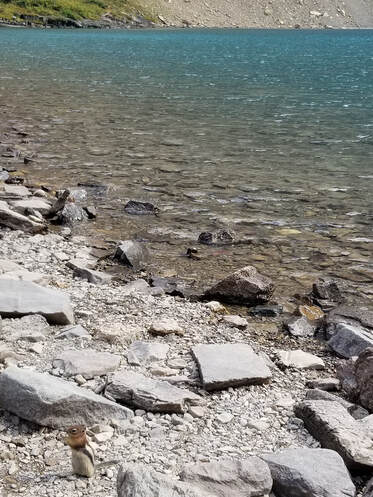
It was a bit disappointing though that Iceberg Lake had no icebergs when we hiked it.

Picture
Picture
Picture
Picture
Picture
Picture

​Oh and be careful with these little guys. They will eat your food and get in your backpack.

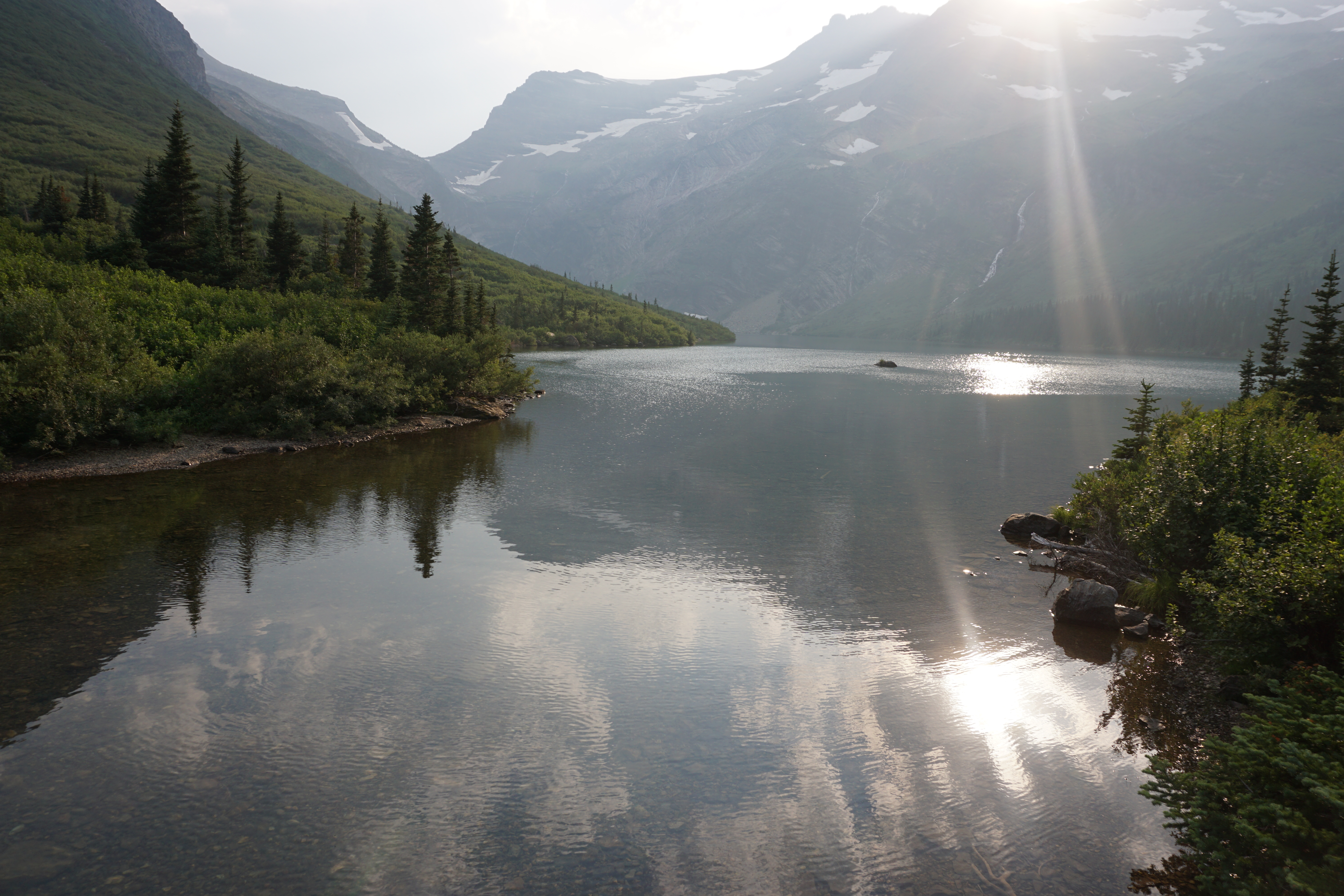
​When I flew over Cracker Lake last year, it did not look as impressive to me as other lakes did, but it must have been because I flew too early in the day. The sun was not shining on its water yet and, as it turns out, Cracker Lake has the most beautiful water color of any lake I’ve visited or seen at GNP. It’s very different seeing it in the shade and the sun.

Picture
Picture

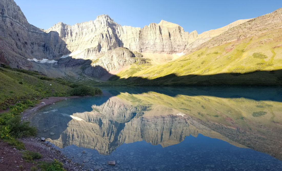
It was quite amazing to see the transition of water color on the lake as the sun rose up over the mountains. I had never seen anything quite like that before.

Picture
Picture
Picture

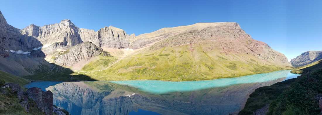
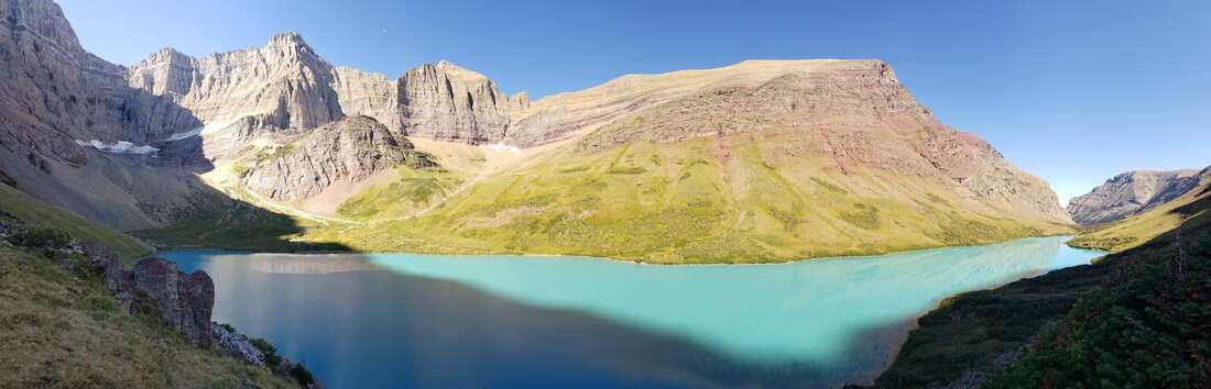
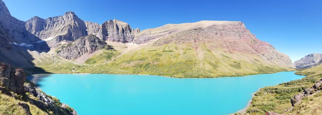
​The details of things like the color of the rocks and the sediment in the water is something one cannot perceive from the air.

Picture

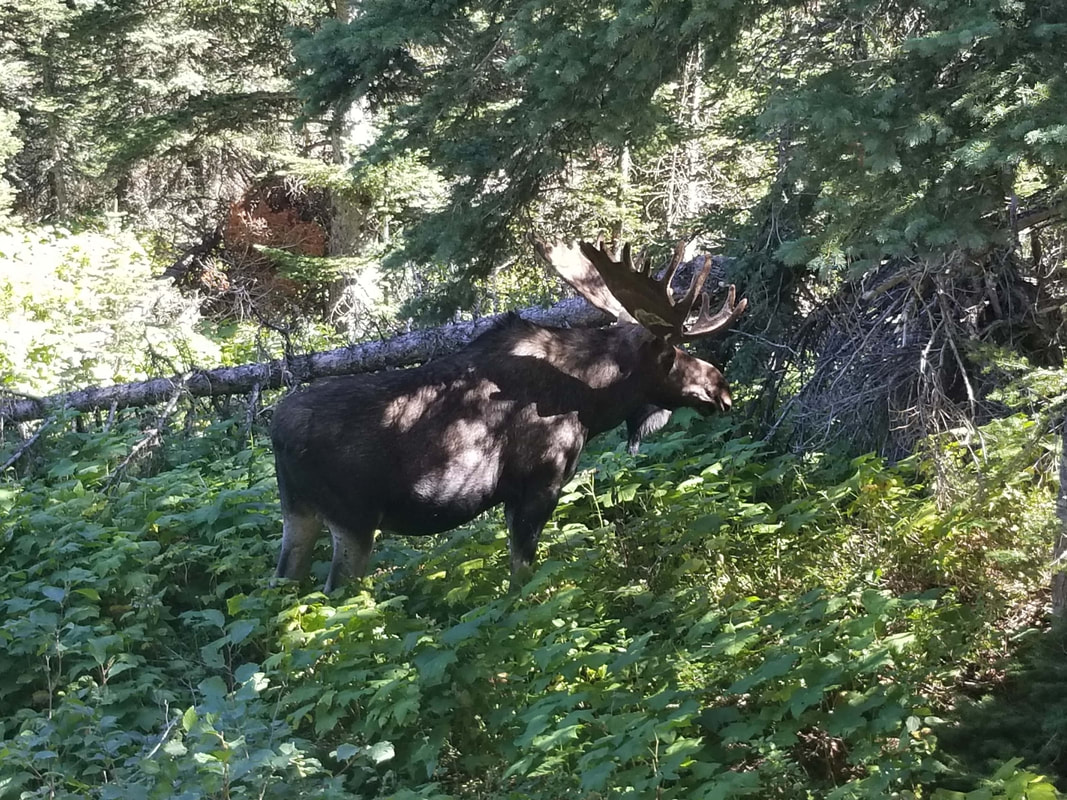
​Glacier is also a great park to view moose, mountain goats (my favorite!), bighorn sheep, and bears of different types but it’s a bit hard to see them from an aircraft.

Picture

There’s no time to be bored in a world as beautiful as ours so get out and explore! 

by Yasmina Platt

Gunsight Lake & Mt. Jackson

A father-daughter adventure

In July of 2013 my daughter and I set out on a camping and climbing trip to Gunsight Lake. We would meet my friend Dustin at camp on Gunsight Lake where we would base our climb of Mt. Jackson. The weather forecast was ideal and we were excited to get on top of some glaciers.

Gunsight Lake is a wonderful back country campground. It is set up like the other back country sites but the proximity to the lake and the views from the campground make this one of my favorite destinations. The hike in to the lake is only 6.5 miles and the elevation gain is a gradual 1500 ft. And there is plenty to see on the way in.

IMG_0762
Ready to hit the trail for an adventure

After a couple miles of slow descent from the trail head we found Deadwood Falls. Here the creek creates some impressive erosive features on the colorful rocks as it hammers it’s way through the surrounding walls. This is a popular spot for hikers to stop and take photos. Remember that drowning is the leading cause of death in GNP so always be careful around slippery rocks and moving water.

IMG_0763
Deadwood Falls area

The initial descent ended when we reached the St. Mary River. Here we found wetlands and meadows ideal for wildlife viewing. This river basin is prime country for moose and bear and hikers usually have sightings of them more often than not. A few prominent peaks loomed around us including Citadel, Dusty Star, and Going-to-the-Sun.

IMG_0768
This is Moose country! (Citadel Mountain)

About four miles in we found the trail branching off to Florence Falls. We decided that would be a good place to stop and eat lunch. From the main trail it was only about one mile to the falls and absolutely worth the extra effort. And no matter what you’ve packed for lunch it’s going to taste a million times better sitting next to those falls!

IMG_0774
Florence Falls

IMG_0780
First full view of Jackson Glacier along the trail (Mt. Jackson on the right)

Arriving at the lake on a hot July afternoon we were anxious to go for a swim and cool off. We quickly set up our tents and headed for the lake shore. The water was cold but not intolerable. We took a brief swim, basked in the warmth of the sun, and enjoyed the views of Mt. Jackson, Gunsight Mountain, Blackfoot Mountain, and Mt. Logan.

IMG_0792
Who wants to swim?

IMG_0783
Our camp site right by the lake

We returned to camp and headed to the food-prep area to make our dinner. Another camper arrived to join us, short of breath and laughing. He had just chased down a deer that ran off with one of his trekking poles. He was able to recover the pole and show us the chewed up grip with deer slobber dripping off it. The deer and marmots here are notorious for being a nuisance like that. They love the salt on grips of poles and soles of shoes so NEVER leave anything out on the ground or within reach of tall deer. I have my own tattered pole handles and flips flops to attest to the determination of these critters.

We went to bed early because we had a big day ahead of us. We planned to climb Mt. Jackson, the 4th of the six 10,000 ft peaks in Glacier, behind Cleveland, Stimson, and Kintla. The climb from the campground would entail just under 5,000 ft elevation gain over a few miles to reach the summit at 10,052 ft. With bellies full of complex carbohydrates we slept soundly with visions of glaciers, mountains, and sparkling waters filling our dreams.

The next morning we awoke early and headed across the suspension bridge on the trail over to Jackson Glacier. From there we branched off-trail and began the ascent of the mountain. My daughter got a little spooked at some of the exposure so when we took a break at 8,400 feet she remained on the ridge while Dustin and I continued to the summit. The remaining 1,500 ft was an easy class 2 and 3 scramble to the top.

It was thrilling to be on the top of Mt. Jackson. On the top we had spectacular 360 degree views. We had also gained a view of the Harrison Glacier. While we were taking summit photos we heard the incredible sound of a monstrous ice chunk cleaving apart from Jackson Glacier and crashing down the cliffs below. Unfortunately we were only able to hear the event and not see it. I would say the sound was similar to a sonic boom followed by continuous thunder with a jet flying overhead, all in about 10 seconds total.

The name of the mountain was changed from a tribal term in 1891 by G.B. Grinnell. The previous name was “Sixikaikoan” which meant Blackfeet Man. According to Jack Holterman in his book Place Names of Glacier National Park this may be the peak that inspired Grinnell with the term “Crown of the Continent” as this is the only 10k peak on the continental divide.


IMG_0878
Celebratory summit hand stand

IMG_0870
Summit view looking SE

IMG_0866
Summit view looking NW over Gunsight Lake

Gunsight Lake is a fantastic destination for a day hike, overnight camp, or as part of the Gunsight Pass trail that goes from the Jackson Glacier Overlook to Sperry Chalet and down to Lake McDonald Lodge (about 20 miles total). This hike can be done from either direction depending on your itinerary. There are waterfalls along the trail and long cascades near the head of the lake. Flora and Fauna are also typically abundant. Don’t forget your bear spray, bug spray, fishing pole and camera.

DSC08182
Morning view from the bridge

DSC08186
Views from the trail

DSC08196
Gunsight Lake from the Gunsight Pass trail looking west

Mt. Brown Fire Lookout

October 2018


Built in 1928-29 and manned full-time until 1971 this lookout stands at 7,487 ft

The Mt. Brown Fire Lookout is a fantastic feature in the Lake McDonald Valley. You’ll find spectacular views, migratory birds, flora and fauna, and currently you can see just how close the Sprague fire came to destroying this historic structure.  This hike however, is not a casual hike and should only be attempted by those in excellent physical condition.

20181020_143425

DSC08803
The sign does NOT mention the lookout

The Mt. Brown trail boasts the most elevation gain of any official trail in the park at 4,325 vertical feet. This is accomplished in only 5 miles so be prepared for a continuous uphill slog! Find the trailhead directly across the road from the Lake McDonald Lodge parking area. The shared trailhead also branches off to Snyder Lakes, Fish Lake, Comeau Pass, and Sperry Chalet.

We hiked this trail in October 2018, just after the Howe Ridge Fire wreaked havoc in the park. It was a weekend of perfect Fall weather. Temps were cool, wind was mild, and skies were clear. An early cold snap weeks earlier turned the trees so the colors were in-your-face vivid.

DSC08802
At first we were in thick forest

IMG_5916
Rising off the forest floor (PC Rachel Payne)

The Sprague Fire of 2017 burned out much of the area surrounding the trail so there were sustained views along the way that were not available in the past. And there was something oddly beautiful about all that black char on the skeletal remains of trees towering around us. The new undergrowth was fresh and green and spoke of new beginnings.

DSC08759

As we got higher and higher along the trail we began to appreciate the prominence of the mountains around us. Peaks in immediate sight were Stanton, Vaught, McPartland, Little Matterhorn, Edwards, and Gunsight. To the south we could see Lake McDonald in its entirety. And we saw from the southern base of Stanton the area of the 2018 Howe Ridge Fire and where it met up with the 2003 Robert Fire.

DSC08799
From within the Sprague Fire we see the Howe Ridge Fire and Robert Fire

You will see quite a few people on this trail because of its popularity but it rarely feels “crowded” because the dauntingly steep grade tends to spread people out sparsely. We saw only a dozen people on the trail this day, but despite the difficulty they ranged in age from adolescent to geriatric. I hope I’m climbing 4,300′ a day when I’m in my 70’s!

DSC08768
Can you see the lookout above?

Mid-to-Late October is a time of year when migratory eagles are passing through this area. We came across two volunteers from the Citizen Science Program who were doing annual raptor counts on one of the rocky outcroppings where the view into the Snyder Valley was prime for seeing birds. Sometimes the lookout is used as a base camp for the raptor count activities. Want to get involved in projects like this? Go here: GNP Citizen Science

DSC08763
The Snyder Lakes and Sperry Chalet trails are ~2000 ft below

IMG_5948
Approaching the lookout. Mt. Brown visible in the trees to the right (PC Rachel Payne)

Of course the views from the lookout are fabulous! We took our time getting the photos we wanted, which certainly included panoramas. Then we had a quick bite. Lunch always tastes good on a mountain and this was no exception. And today our dessert included some Ibuprofen because we knew we would “kneed” it for the pounding our joints would take on the way down.

This is a fairly popular winter trail as well. I have snowshoed this trail before and I plan to ski it this year. Who knows, maybe I will even do a winter ascent of the Mount Brown summit!

Fire Line
The fire came within 100 yards of the lookout !

IMG_5994
Starting off from Lake McDonald. The classic colored rocks


Piegan Mountain – Glacier National Park

August 21, 2018 by Joanna Adams   www.adventureadams.com

Right now, a lot of the park is under fire and what’s not seems to be covered in an oppressive blanket of smoke. I am so thankful we at least got one more hike in before the smoke came.

There are so many great peaks in Glacier. I picked this one out because it seemed like a good beginner peak without a lot of technical spots or intense climbing.

We started our trek early. . . I always do when going to Glacier. The swarms of people seem to start congregating early and with the crazy intense heat we’ve been having lately, it is great to get a head start.

By the time I got the trail head at Lunch Creek, I had already downed a full cup of coffee so felt quite ready to take on the journey. The climbers trail at Lunch Creek is super easy to find.

Continue reading “Piegan Mountain – Glacier National Park”

%d bloggers like this: