Climbing, part 2

Preparation

Climbers Ascending a Class III Gulley

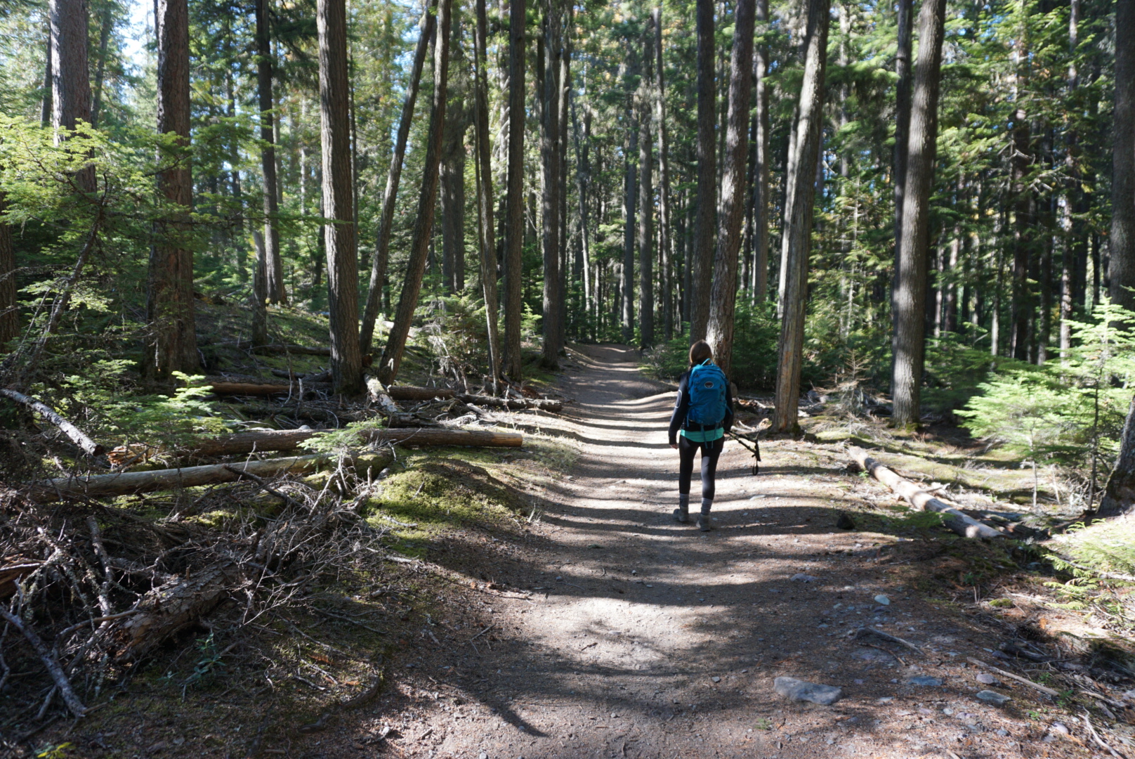
Now that you’ve read the overview, purchased a few guide books, and decided climbing in Glacier is for you it’s time to start planning a climb. I can’t stress enough the importance of starting with peaks and routes that are within your fitness level and climbing experience. Don’t bite off more than you can chew or you might not have a good time. Even worse, you could have a bad outcome.

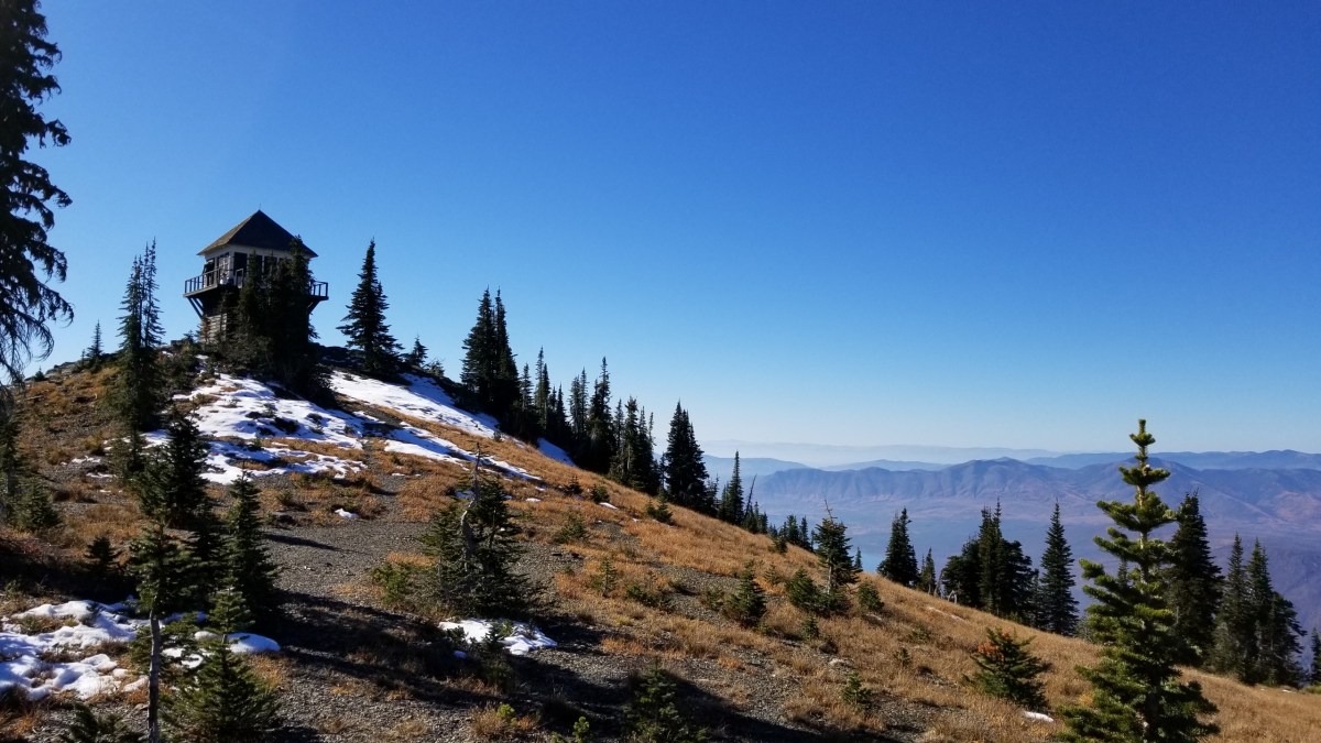
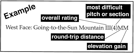
Let’s look at difficulty ratings. The Glacier Mountaineering Society has developed a system to quantify/qualify the difficulty of a particular climb. This is the standard by which the vast majority of us assess an adventure we might be pursuing. If you don’t know what distance and elevation gain you can handle I recommend you start with an easy climb such as Mount Oberlin and see how it goes for you.

GMS Climb Classification System

Class I (1) Easy  = Trail hiking 

Class II (2) Moderate = Low angle scrambling. 

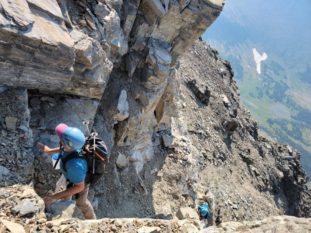
Class III (3) Difficult = High angle scrambling, moderate cliffs, considerable exertion. Rope might be necessary for beginners. (Most of the basic climbs in the park. I like to think of this class as where you need three points of contact to climb)

Class IV (4) Very Difficult = Higher angle cliffs, increased exposure. Belaying rope often required. (I like to think of this class as requiring four points of contact)

Class V (5) Severe = High angle cliffs, severe exposure. Protection placed by leader. Technical climbing experience necessary. 

Class VI (6) Extremely Severe = Direct aid technical climbing. Overall rating in the classification reserved for only the biggest technical climbs. (example North Face of Mt. Siyeh or East Face of Mt. Gould) 

DistanceAmountElevationAmount
(S) Short1 – 6 miles(S) Short<3,000′
(M) Medium6 – 12 miles(M) Medium3,000′-4,500′
(L) Long12 miles +(L) Long>4,500′

Helmets

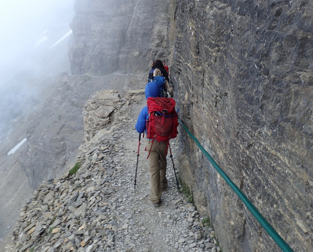
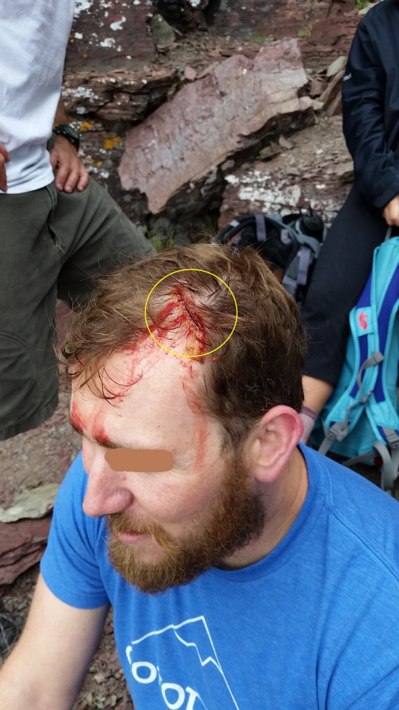
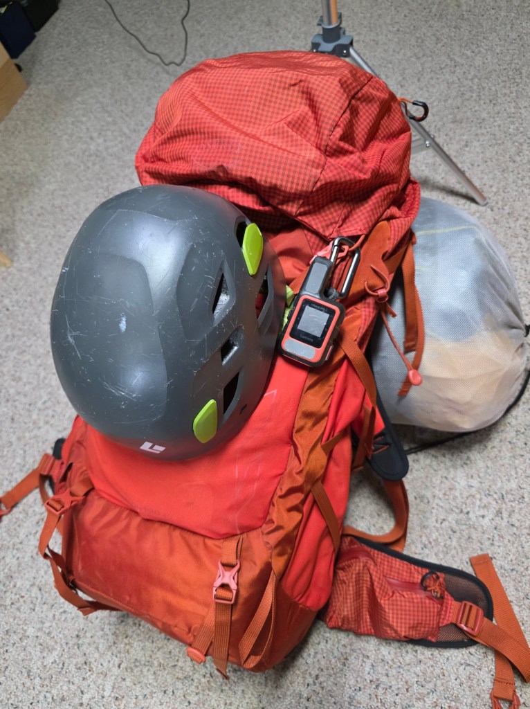
Take a helmet. Wear a helmet. Make helmets COOL again! Helmets are a good idea (mandatory if you climb with me) on anything Class III or higher, or Class II if you are next to cliffs where rockfall is possible (such as traversing below Reynolds to get to the route on the back side). Helmets help protect from rockfall (caused by fellow climbers, goats, or mother nature). They come in handy when ascending ledges as you can easily strike your head on rocks as you are moving up (see photo). Lastly, you could easily slip on wet or loose rock on inconsequential terrain but strike your head on a rock.

A climber hit his head on a sharp edge

The Climbing Day-Pack

Osprey Talon Pro 40L Pack

Hope is not an action plan

Loading your pack can get you really hyped for your adventure. A climbing pack is a little different than a hiking pack. It’s a good idea to have a checklist so you don’t forget something important. You’ll want a well-fitting pack of 25L to 40L. Prepare for the worst. Below is a list of items I have in my pack every time I go off-trail. I’m also including a checklist I find helpful.

The Ten Essentials (survival tools in case you get stranded or injured)

  • Navigation: Maps, GPS, InReach, Compass
  • Headlamp + batteries
  • Sun/Wind Protection: Sunglasses, Sunscreen, Hat, UPF Clothing, Buff
  • First Aid: This could be a topic of its own, but start with the basics
  • Knife: Sometimes a multi-tool is handy. Also some repair gear
  • Fire: Fire starter, matches/lighter, tinder
  • Shelter: Light bivy in summer, Insulated bivy in the shoulder season
  • Extra Food: Calorie dense foods to survive an extra night
  • Extra Water: Plan an average of 3 liters/day and ability to filter more
  • Extra Clothing: Layering is key. Cover your head and hands as a priority

Other Items I Carry With Me

  • Helmet
  • Accessory cord/Paracord
  • Route specific: 30M rope, belay device, 2 lockers, 2 non-lockers, alpine harness
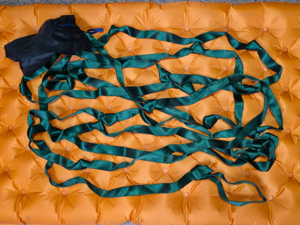
  • 30′ Webbing Hand Line (to help someone up or down a difficult short pitch)
  • Trekking Poles (can also help with shelter, splinting, carry-outs)
  • Bear Spray
  • Insect Repellent
  • Chapstick
  • Toilet Paper, wet wipes, ziplock to pack out TP, trowel to bury poo
  • Rain cover for pack
  • 6′ of Duct Tape
  • Umbrella (great for shade, rain, and hazing goats)
  • Gaiters (to keep scree out of boots & keep pants/socks dry from wet grass)
A webbing hand-line has knots a climber can use to climb up or down short pitches where holds are sparse. The belayer wraps the end around a rock and uses friction to hold the climber

Clothing Choices

  • Buff, Hat (ball cap or beanie)
  • Rain Jacket and Pants
  • Base and Mid layers: wicking material (no cotton)
  • Gloves: 1 pair light gloves, 1 pair insulated gloves
  • Extra socks
  • Footwear: I prefer an approach type boot with high ankle support. Good grip is very helpful. This also affords protection of the ankle from tumbling rock

Food Choices

  • Rapid Energy: candy bar, fruit, energy gel
  • Endurance Fuel: Cliff type bars, jerky, nuts
  • Satisfying: a nice summit sandwich and a celebratory shot of whiskey
  • Electrolytes: I prefer LMNT. 1/3 of my H2O consumption is with electrolytes
  • Don’t forget to pack a little extra in case you have to spend the night

Optional Gear You May Find Useful

  • Binoculars
  • Fishing Gear
  • Nice Camera and Tripod
  • Pack Chair or Seat Cushion
  • Micro-spikes or Crampons
  • Mountaineering Axe
  • Snowshoes
  • Anemometer
  • Flora and Fauna info cards

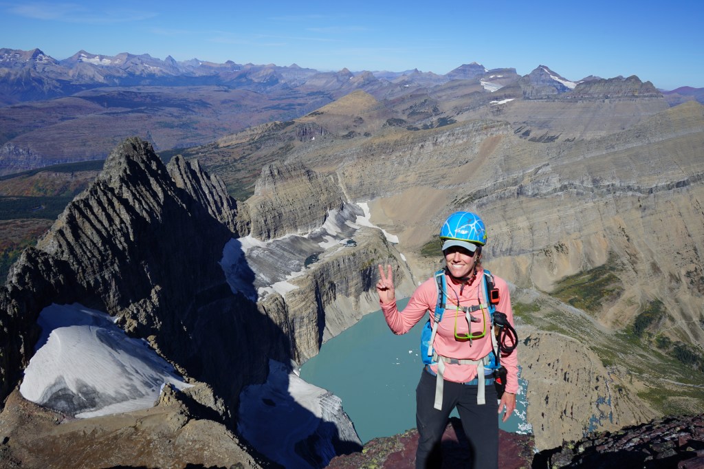
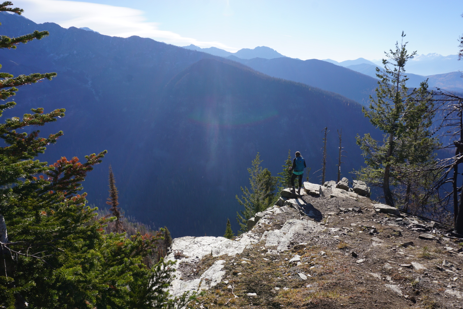
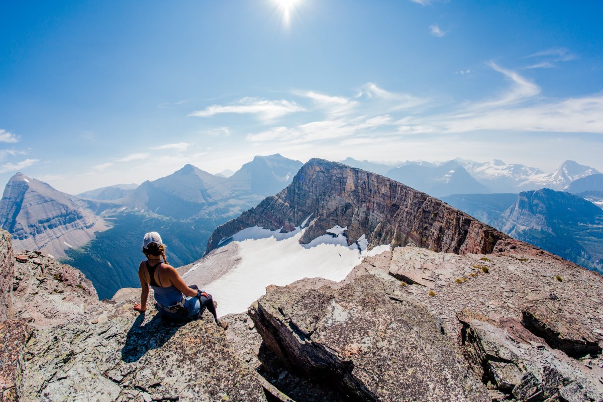
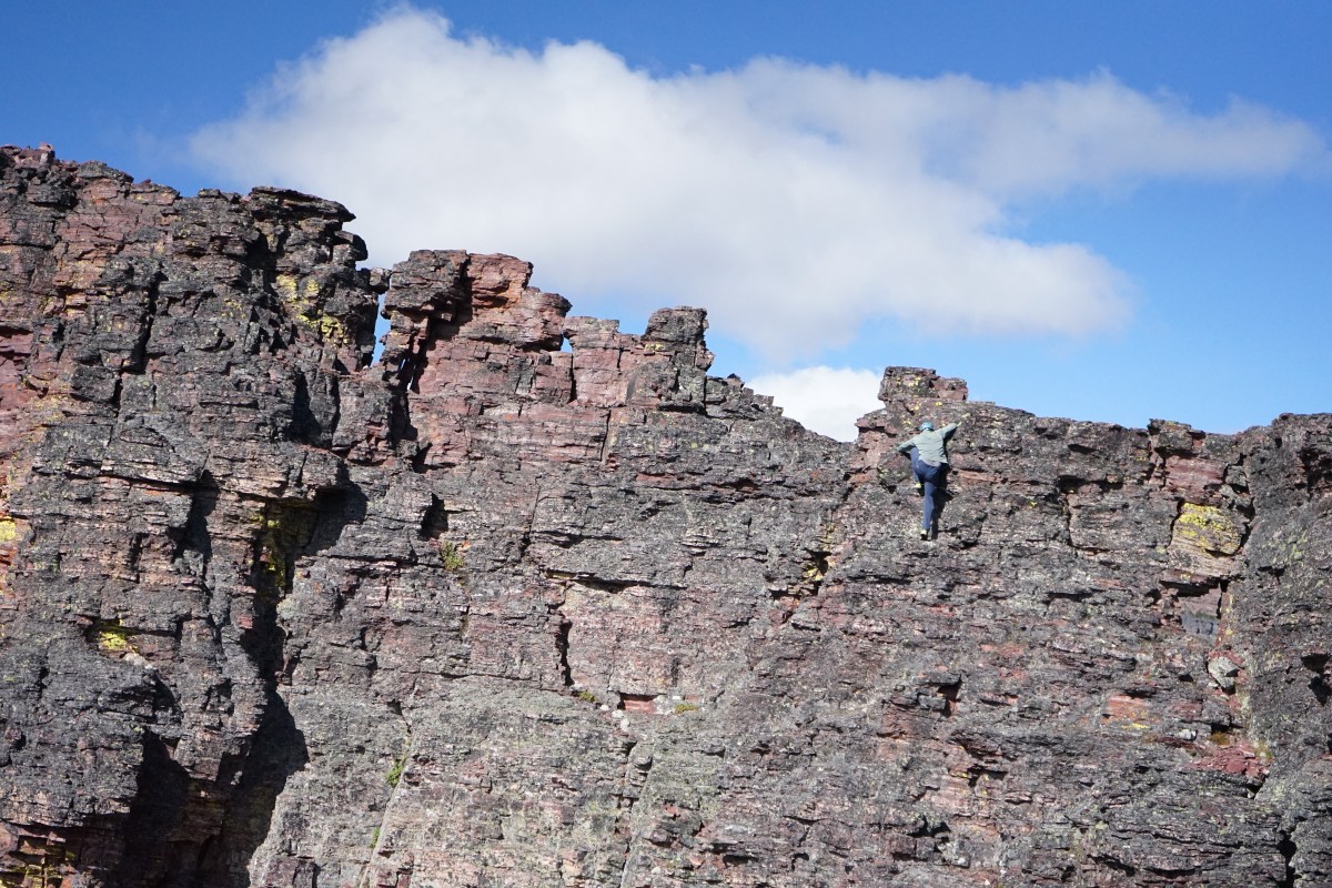
A climber on Mount Gould above Gem, Salamander, and Grinnell Glaciers

You might think all of this gear would weigh a ton and take up too much room. If you pack wisely and use modern light-weight gear you can end up with a compact, efficient, and robust pack at under twenty pounds. So, you’ve got a peak and route planned and your bag is packed. Now it’s time to go out and climb! See part three for climbing techniques and tips…

Did I mention that helmets are COOL?

Mt. Brown Fire Lookout

October 2018


Built in 1928-29 and manned full-time until 1971 this lookout stands at 7,487 ft

The Mt. Brown Fire Lookout is a fantastic feature in the Lake McDonald Valley. You’ll find spectacular views, migratory birds, flora and fauna, and currently you can see just how close the Sprague fire came to destroying this historic structure.  This hike however, is not a casual hike and should only be attempted by those in excellent physical condition.

20181020_143425

DSC08803
The sign does NOT mention the lookout

The Mt. Brown trail boasts the most elevation gain of any official trail in the park at 4,325 vertical feet. This is accomplished in only 5 miles so be prepared for a continuous uphill slog! Find the trailhead directly across the road from the Lake McDonald Lodge parking area. The shared trailhead also branches off to Snyder Lakes, Fish Lake, Comeau Pass, and Sperry Chalet.

We hiked this trail in October 2018, just after the Howe Ridge Fire wreaked havoc in the park. It was a weekend of perfect Fall weather. Temps were cool, wind was mild, and skies were clear. An early cold snap weeks earlier turned the trees so the colors were in-your-face vivid.

DSC08802
At first we were in thick forest

IMG_5916
Rising off the forest floor (PC Rachel Payne)

The Sprague Fire of 2017 burned out much of the area surrounding the trail so there were sustained views along the way that were not available in the past. And there was something oddly beautiful about all that black char on the skeletal remains of trees towering around us. The new undergrowth was fresh and green and spoke of new beginnings.

DSC08759

As we got higher and higher along the trail we began to appreciate the prominence of the mountains around us. Peaks in immediate sight were Stanton, Vaught, McPartland, Little Matterhorn, Edwards, and Gunsight. To the south we could see Lake McDonald in its entirety. And we saw from the southern base of Stanton the area of the 2018 Howe Ridge Fire and where it met up with the 2003 Robert Fire.

DSC08799
From within the Sprague Fire we see the Howe Ridge Fire and Robert Fire

You will see quite a few people on this trail because of its popularity but it rarely feels “crowded” because the dauntingly steep grade tends to spread people out sparsely. We saw only a dozen people on the trail this day, but despite the difficulty they ranged in age from adolescent to geriatric. I hope I’m climbing 4,300′ a day when I’m in my 70’s!

DSC08768
Can you see the lookout above?

Mid-to-Late October is a time of year when migratory eagles are passing through this area. We came across two volunteers from the Citizen Science Program who were doing annual raptor counts on one of the rocky outcroppings where the view into the Snyder Valley was prime for seeing birds. Sometimes the lookout is used as a base camp for the raptor count activities. Want to get involved in projects like this? Go here: GNP Citizen Science

DSC08763
The Snyder Lakes and Sperry Chalet trails are ~2000 ft below

IMG_5948
Approaching the lookout. Mt. Brown visible in the trees to the right (PC Rachel Payne)

Of course the views from the lookout are fabulous! We took our time getting the photos we wanted, which certainly included panoramas. Then we had a quick bite. Lunch always tastes good on a mountain and this was no exception. And today our dessert included some Ibuprofen because we knew we would “kneed” it for the pounding our joints would take on the way down.

This is a fairly popular winter trail as well. I have snowshoed this trail before and I plan to ski it this year. Who knows, maybe I will even do a winter ascent of the Mount Brown summit!

Fire Line
The fire came within 100 yards of the lookout !

IMG_5994
Starting off from Lake McDonald. The classic colored rocks


Advice from a Ranger

from GNP Facebook Page, author unknown

Advice From A Ranger (tr)

Remember to always wear your hat,

take a good honest look at your shoes,

they’ll be your friend for the next sixteen miles,

then repeat after me:

water is life, water is life, water is life,

take a drink even when you’re not thirsty,

and then look around you,

wherever you are,

you are no different,

than the alpine paintbrush or the grizzly bear,

than the aspen, or the mountain goat, Continue reading “Advice from a Ranger”

Making Memories Along the Highline

by Amy Grisak

Amy is a freelance author and photographer in Great Falls, MT

As each summer flits by, it’s more obvious that time is precious with our children. For many summers, my girlfriends and I ventured into Glacier for a grand “Moms’ Hike Out” exploring the trails and chalets as we recharged our mental batteries. This year, we included our kids as three of us brought our 11 year olds on an overnight trip to Granite Park Chalet.

Securing a room at the chalet is competitive reservations at its finest. There were four of us, including my son Samuel, on the computers at the appointed date in January ready to type as soon as the 8 a.m. hour hit. Although all of us submitted reservations, only two of us were given the dates we requested, but we had our spot! From then it was watching the copious snowfall and counting down the days until mid-July.

OLYMPUS DIGITAL CAMERA

Continue reading “Making Memories Along the Highline”

A Great Hike near Marias Pass

Calf Robe Mountain

A man does not climb a mountain without bringing some of it away with him and leaving something of himself upon it. Sir Martin Conway

Calf Robe Mountain is part of the Continental Divide and is located on the Firebrand Pass trail which starts at the Lubec Lake Trailhead. Elevation at the peak is 7,920 ft and ranks 173 of 234 named peaks in the park. This is not a challenging hike/climb even though round trip mileage is around 10 miles and elevation gain is 2,800 ft. Most of the distance is covered on-trail versus off-trail.

6864663235_0086edfe78_b
Near the trailhead along Hwy 2

Continue reading “A Great Hike near Marias Pass”

Piegan Mountain – Glacier National Park

August 21, 2018 by Joanna Adams   www.adventureadams.com

Right now, a lot of the park is under fire and what’s not seems to be covered in an oppressive blanket of smoke. I am so thankful we at least got one more hike in before the smoke came.

There are so many great peaks in Glacier. I picked this one out because it seemed like a good beginner peak without a lot of technical spots or intense climbing.

We started our trek early. . . I always do when going to Glacier. The swarms of people seem to start congregating early and with the crazy intense heat we’ve been having lately, it is great to get a head start.

By the time I got the trail head at Lunch Creek, I had already downed a full cup of coffee so felt quite ready to take on the journey. The climbers trail at Lunch Creek is super easy to find.

Continue reading “Piegan Mountain – Glacier National Park”